3D Laser Scanning Deliverables
GPRS’s team of in-house engineers, architects and CAD technicians will produce custom deliverables for your project, ranging from point cloud data 2D CAD drawings, 3D BIM models, 3D mesh models, TruViews, and 3D virtual tours. Deliverables can be provided at any level of detail in a variety of formats including Revit, AutoCAD, ReCap, Navisworks, Civil 3D, BIM 360, A360, JetStream Viewer, and more.
GPRS Laser Scanning Deliverables

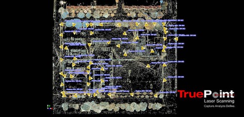
Point Cloud Data (Raw Data)
- A point cloud is the set of 3D data points captured by the laser scanner. They contain X, Y and Z coordinates of every visible detail of a project site. These include objects like doors, windows, walls, MEP equipment, ductwork and steel structures, to name a few. You can import the point cloud into CAD software to visualize the area. The data will look like a pixelated, digital version of your site. Once imported, point cloud data can be parsed, manipulated and modified to suit a user’s needs.
Deliverable: PTG or E57 point cloud files and Autodesk Recap files in .rcs and .rcp format.

2D CAD Drawings
Point cloud data is imported into AutoCAD software to create 2D CAD drawings with great precision. Floor plans, sections and elevations are used for construction planning and building modifications. 2D CAD software allows technicians to document and annotate drawings with text, dimensions, leaders, and tables. Data can be parsed, manipulated and modified to suit a user’s needs.
Deliverable: 2D sheets in .rvt, .dwg, .dgn, or .pdf formats.

3D BIM Models
GPRS has mastered the technology for converting point clouds into 3D BIM models to aid the planning and design needs of any project. A 3D BIM model provides a geometrically accurate model of a building or site, capturing spatial relationships, infrastructure and manufacturer details, as well as property and layer information and other pertinent aspects of the site. 3D BIM models provides users with the ability to break down building parts by elements or layers and see how they fit into a single finalized structure. Users can isolate walls, columns, windows, doors, etc., and alter the design. 3D BIM models are revolutionizing the way projects are delivered across industries, adding intelligence and efficiency to project execution.
Deliverable: 3D models in software such as Revit, AutoCAD, Microstation, Solidworks, Navisworks. Modeling Options: Standard Detail, High Detail, Very High Detail (see below).

3D Mesh
A 3D mesh in .fbx, .stl, .obj, and .ply file formats can be created from a point cloud. GPRS’s team of CAD technicians use the data set of x,y,z coordinates to generate a triangulated mesh from the 3D points. Meshes are volumetrically accurate, high density and high resolution. Meshes allow clients to view the object’s geometry inside a CAD environment without having to navigate a point cloud. Files are delivered in a compact, easy to use format. Meshes can be used for representing scanned elements with fine, organic details such as monuments and statues that are otherwise difficult to reproduce in CAD. Mesh files of stadiums and arenas have been used to develop mixed reality experiences during sporting events.
Deliverable: 3D mesh in .fbx, .stl, .obj, and .ply file formats.

TruViews
TruView is a file used in portable software designed for easy and intuitive sharing of point clouds, design models, mark-ups and more. TruViews are 3-dimensional photographs overlaid on top of the point cloud data. Since the TruViews are overlaid on the scan data, clients are able to take basic dimensions directly from the viewer for estimating clearances, and distances, etc. TruViews are useful for those who have not travelled to the site and for those who have been to the site but need to recall specific details of a particular area.
Deliverable: TruView portable software allows you to open and view the LGS format of the point cloud published by GPRS, as well as overlay IFC (3D Model) files. TruView was previously referred to as JetStream.

3D Virtual Tour From Point Cloud
3D virtual tour is a collection of 360° panoramic rotating images, “stitched” together to form a full, 360° view of a location. Our 3D virtual tour utility lets your team tour the location and add digital notes. The virtual tour can be viewed through desktop computers, laptops, tablets and mobile devices.
Deliverable: A customizable MP4 vide file format flythrough or point cloud flythrough from Recap.

Advanced Analysis & Calculations
We provide custom analysis and calculations with high precision such as dimensional callouts, tank calibration analysis, prefabrication of panels, accident analysis, floor flatness and levelness analysis, deviation analysis, deformation analysis, new construction verification, volume calculations, wall plumb analysis, staircases, elevator shaft analysis and so much more. The data gathered by laser scanning is a powerful tool for solving complex challenges.
3D BIM Modeling Options
Below are the level of detail descriptions for BIM modeling. The features are modeled to your project’s specific scope and proposal. By using these detail specifications to scope projects, we can clearly communicate the precision requirements of the BIM model for faster project execution.

Standard Detail Modeling
Similar to schematic design or design development. The Model Element is graphically represented within the Model as a generic system, object, or assembly with approximate quantities, size, shape, location, and orientation. Non-graphic information may also be attached to the Model Element.

High Detail Modeling
The Model Element is graphically represented within the Model as a system, object or assembly in terms of quantity, size, shape, location, and orientation. Non-graphic information may also be attached to the Model Element. Model elements equivalent to traditional construction documents and shop drawings. This may include the modeling of the systems as a specific intelligent BIM system with attributes associated with that system type, if selected.

Very High Detail Modeling
The Model Element is graphically represented within the Model as a specific system, object, or assembly in terms of quantity, size, shape, orientation, and interfaces with other building systems. Non-graphic information may also be attached to the Model Element. This may include the modeling of the systems as a specific intelligent BIM system with attributes associated with that system type, if selected.
Most Common File Formats
- .coe
- .dwg
- .dxf
- .e57
- .fbx
- .fls
- .las
- .lfm
- .lgs
- .msh
- .obj
- .pcg
- .ply
- .pod
- .ptg
- .pts
- .ptx
- .ptz
- .rcs/.rcp
- .rvt
- .stl
- .svy
- .txt
- .vrml
- .xml
- .xyz
We Can Help You Determine The Right Deliverables
- How to select the right deliverable for the job—discover all available types of scan to BIM deliverables and determine which ones best suit your needs
- How to transfer the data efficiently—learn the pros and cons of different data transfer options and identify the best ones to receive your project
GPRS Sample Deliverables
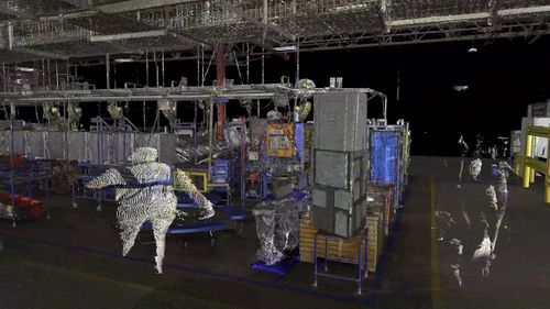
Point Cloud Data (Raw Data)
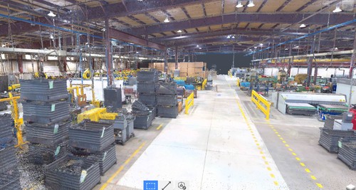
Colorized point cloud of facility that fabricates rollers and steel tubes.
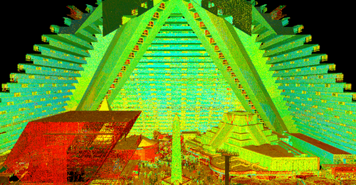
Intensity map point cloud of the Luxor Hotel in Las Vegas.
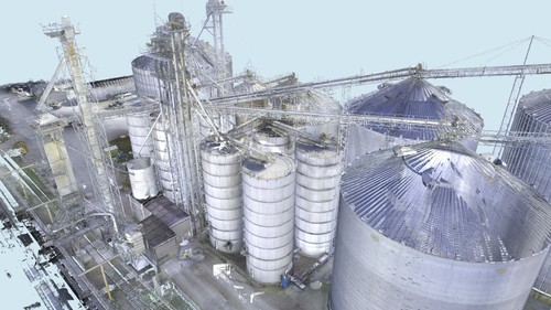
Point cloud of grain silos.
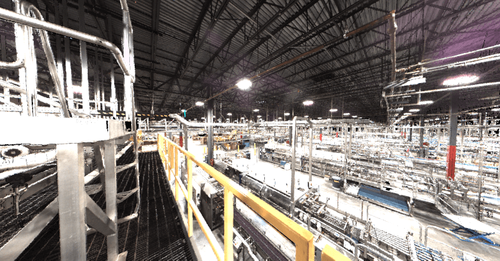
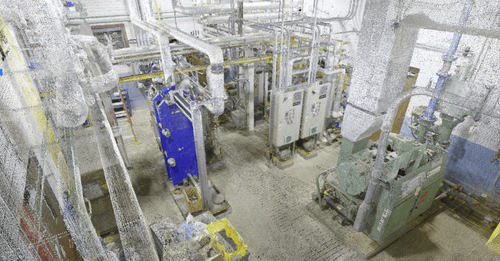
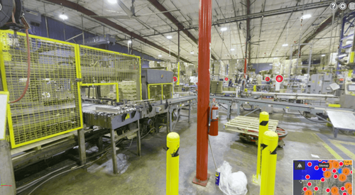
Colorized point cloud of manufacturing line.
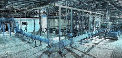
Colorized point cloud of the water treatment plant purification system.
Colorized point cloud of engine test cell support system.
2D CAD Drawings
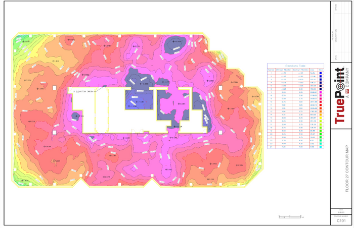
Elevation map and floor contours.
2D plans of elevator shaft alignment.
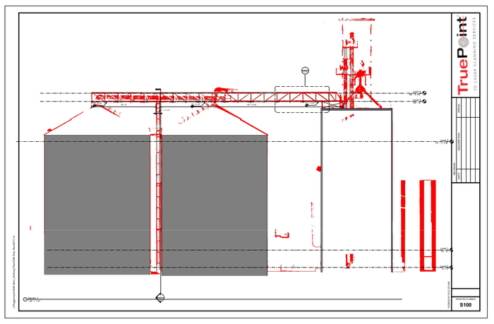
2D drawings of grain silos and overhead bridges and conveyor.
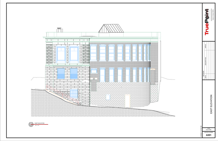
Exterior elevation of historic library.
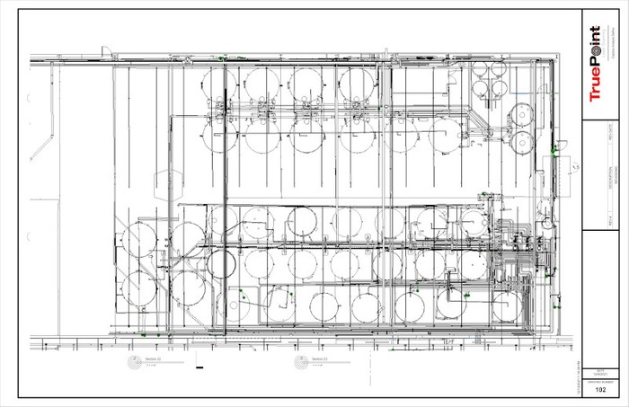
2D floor plan of industrial, automotive & fleet lubricants manufacturing facility.
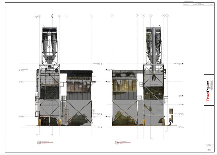
2D CAD elevations of structural tower in paper mill.
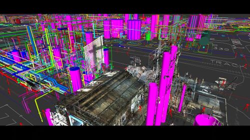
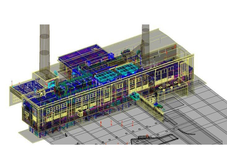
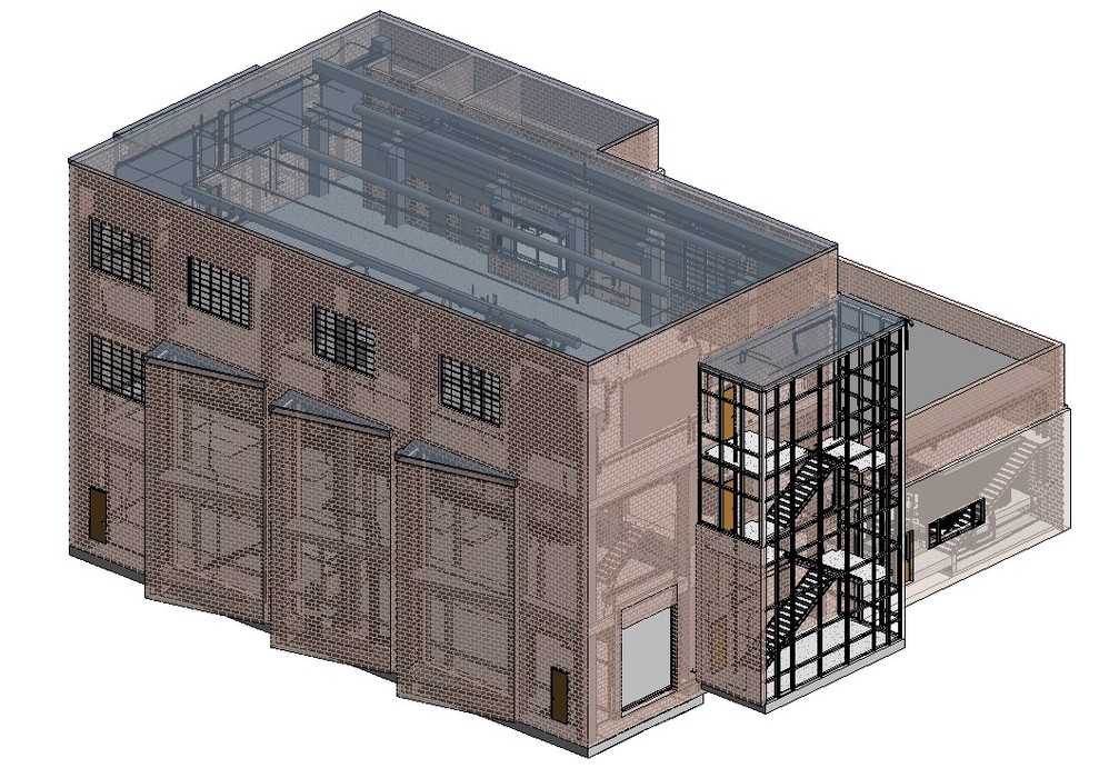
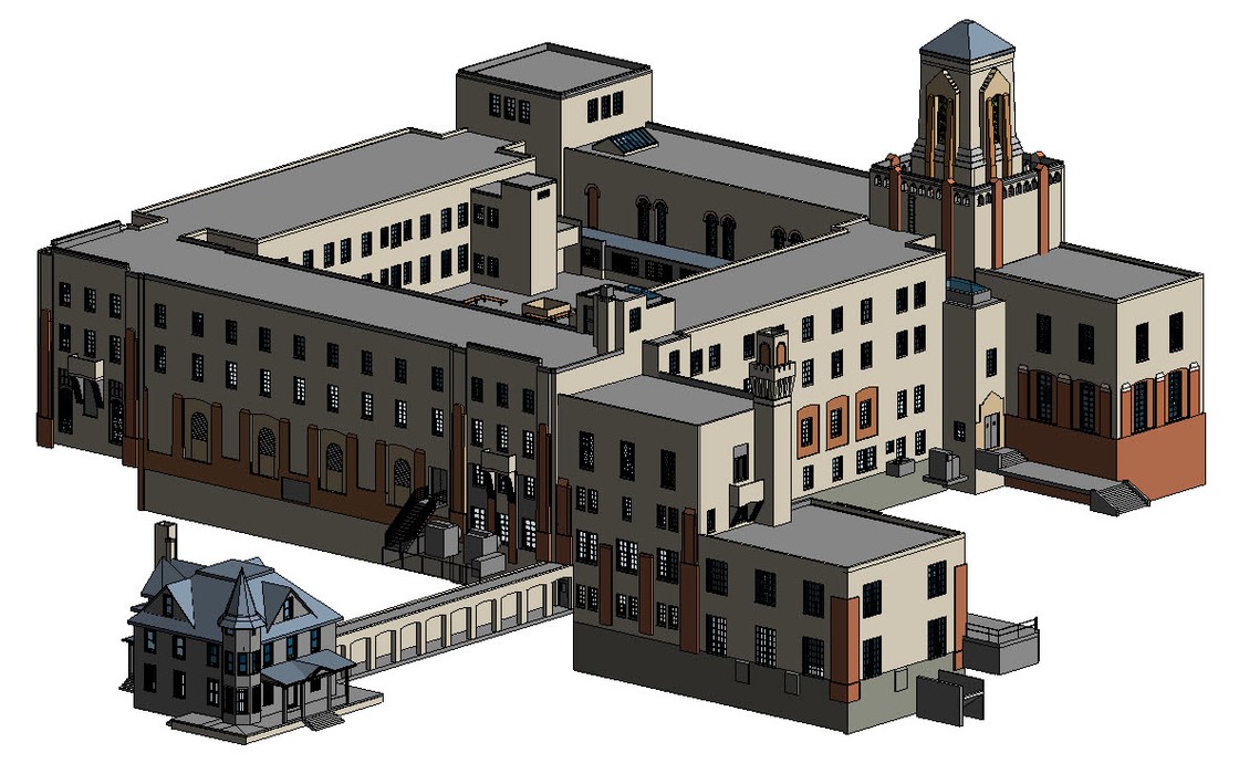
3D BIM Models & 3D Non-Intelligent Models
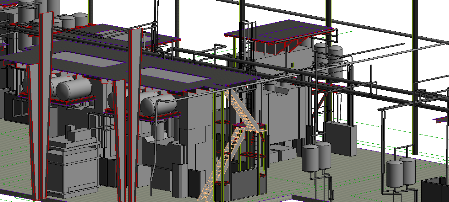
3D BIM model of an industrial facility.
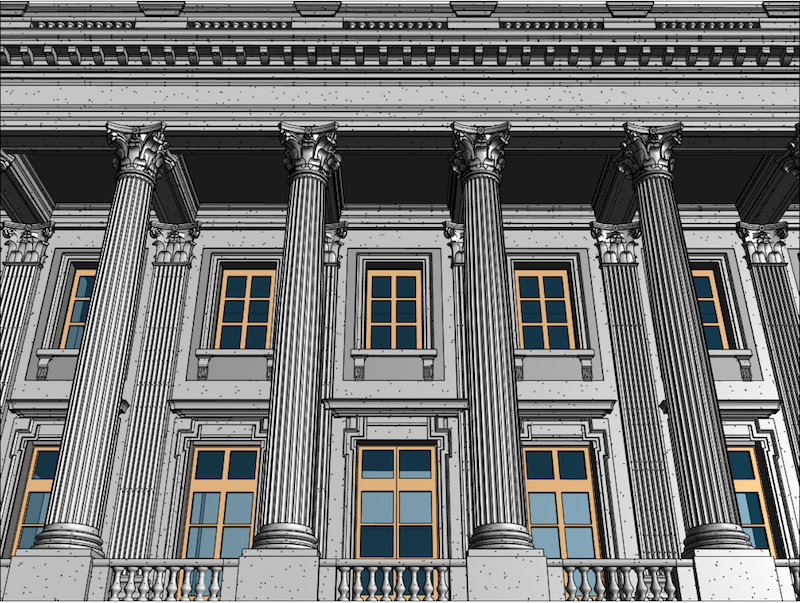
3D BIM model of historic building in Philadelphia.
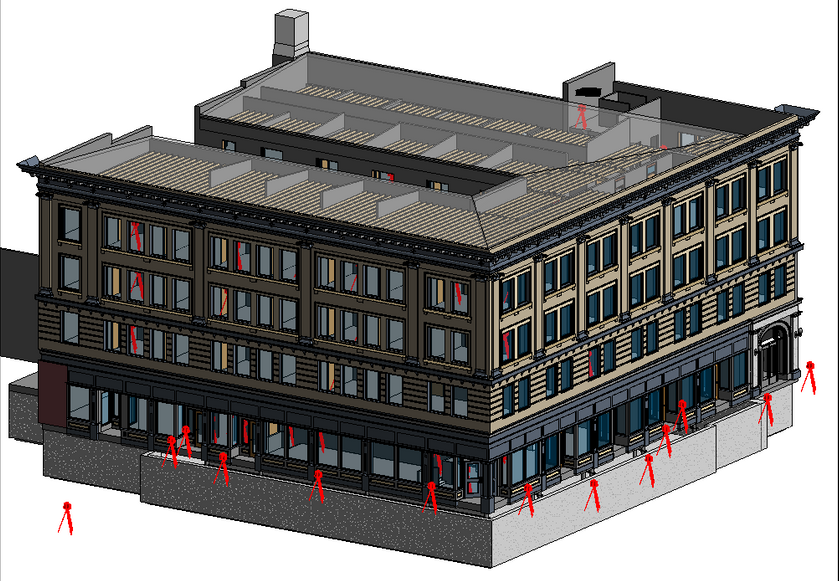
3D Building Information Model of historic building in Denver.
3D wireframe view of interior of power plant.
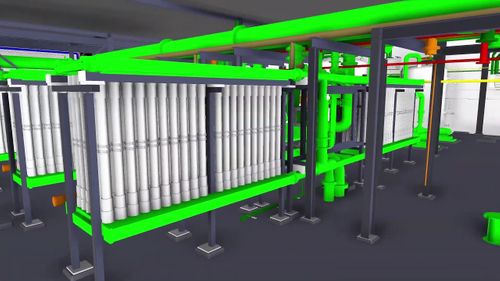
LOD 300 Structural/MEP model of a water treatment facility.
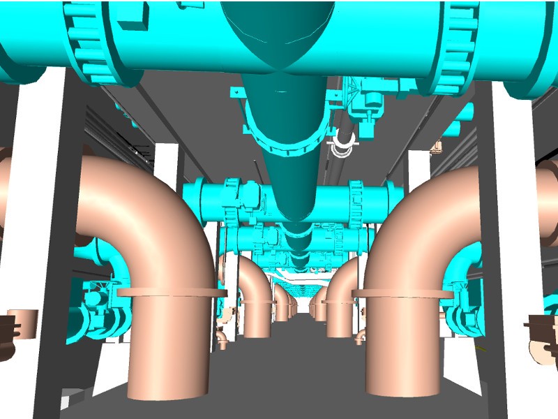
3D model of main pipe gallery in water treatment facility.
3D model of historic university building.
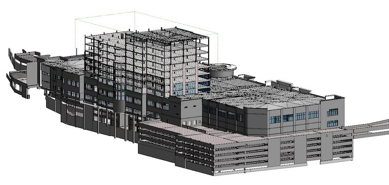
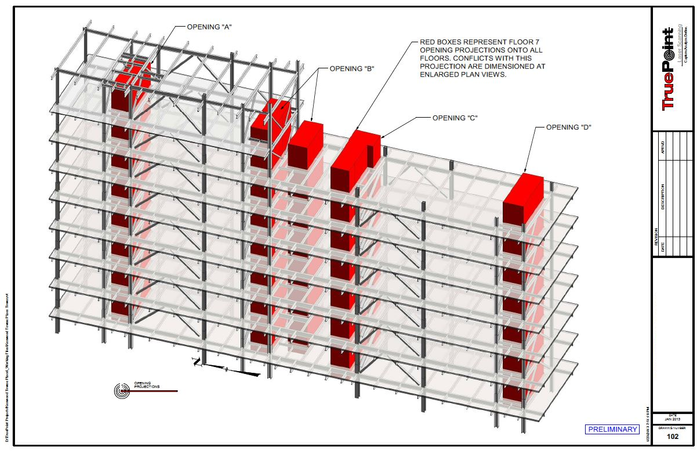
3D BIM model of 15-story building structure for design/build project.
TruView
- Photo-Realistic Point Cloud Rendering in Any of the Possible Formats:
- JetStream, TruViews, RealViews, and BubbleViews
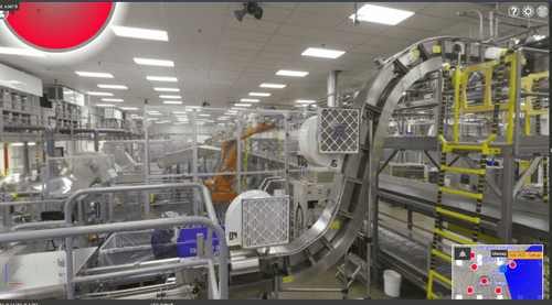
TruView of manufacturing facility.
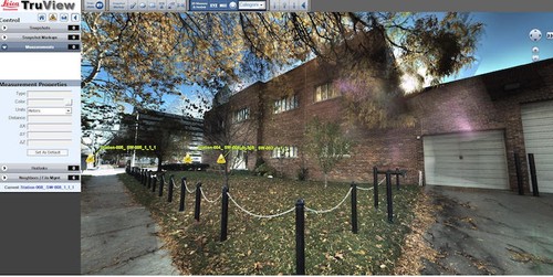
Leica TruView of building in Detroit, Michigan.
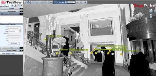
TruView screencapture of hotel entrance.
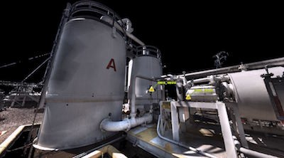
TruView of a Vapor Recovery Unit at a Fuel Distribution Company.
TruView of manufacturing facility

TruView of industrial facility.
TruView site map of city block.
Fly-Through Videos