3D Laser Scanning Universities & Educational Sites
3D Laser Scanning Schools, Universities & Educational Sites
From entire schools to campus buildings to stadiums and mechanical rooms, GPRS has extensive experience 3D laser scanning schools, universities, colleges, and institutions -- any educational site.
You can trust our team to provide the best experience in laser scanning by walking you through the entire process from pre-planning to final deliverables. GPRS brings expertise in many areas, including engineering, architecture, information technology and construction. Having this combination of knowledge is integral to providing you with deliverables that will save your team time and money on your next project or renovation.
Experienced project managers use Leica survey-grade laser scanners to capture exact dimensions and measurements of your project site with an accuracy of 2-4mm. Our in-house team of engineers, architects and CAD technicians create custom deliverables such as point clouds, 2D drawings and 3D models. We use software such as Revit, AutoCAD, ReCap, Navisworks, Civil 3D, BIM360, A360, Bentley, ClearEdge EdgeWise, Leica Cyclone, Faro As-Built, Cintoo, NavVis Ivion and more.
For more information on 3D laser scanning schools, universities and educational sites, call 419-843-7226 or email laser@gprsinc.com. We’re currently offering 10-minute presentations – would you like to schedule one? Click here.
Project Examples
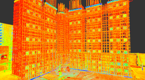
University of Wisconsin Engineering Hall
GPRS 3D laser scanned The University of Wisconsin Engineering Hall reaction wall to determine the location of steel embed openings on the face of wall (+/- 75) prior to installing forms. Intensity map point cloud files, 2D AutoCAD elevation drawings, custom wall plumb analysis and a 3D Revit model were provided to the client.

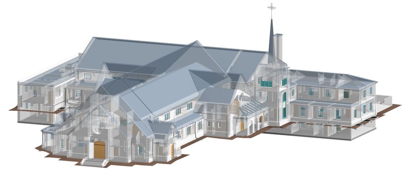
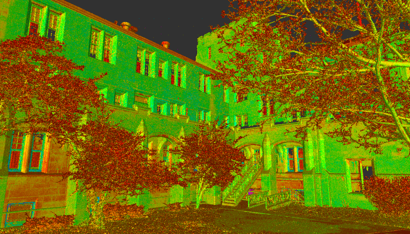
Howard University Campus Building
This Howard University vacant campus building was 3D laser scanned for historical documentation. The client is repurposing the building and desired to preserve the architectural details. GPRS CAD designers utilized colorized 3D laser scan data to generate an LOD 350 model and 2D AutoCAD elevations with point cloud overlay.
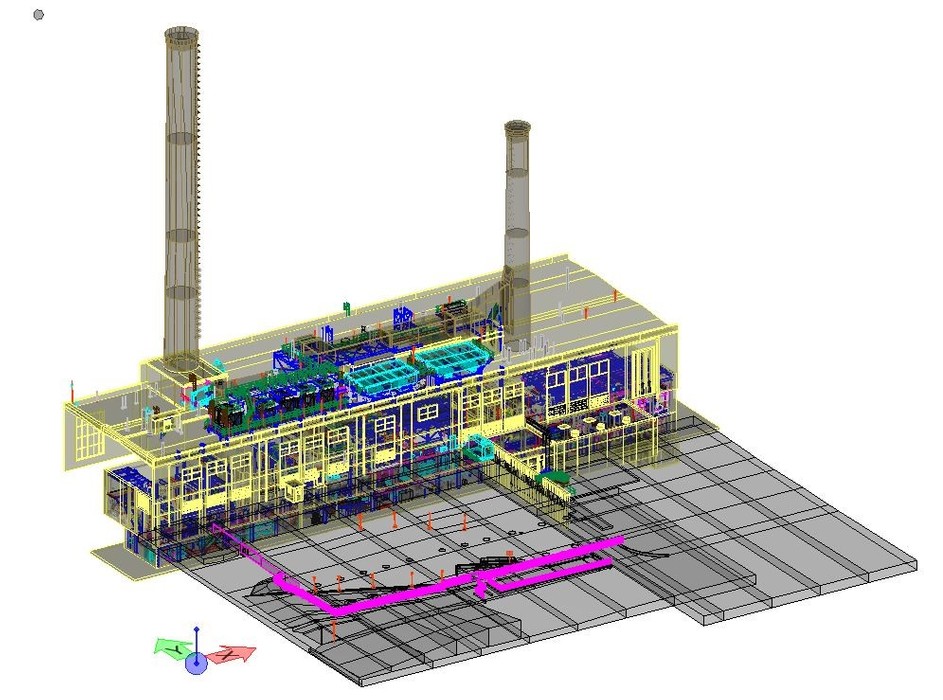
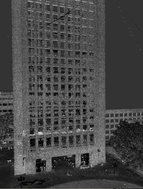
University of Michigan Central Power Plant
GPRS provided 3D laser scanning and modeling services for a Power Plant in Ann Arbor, Michigan. The objective was to as-built survey the 5-level building, basement, exterior facades, rooftop, electrical switch gear rooms, vaults and interstitial space below the control room. GPRS generated a 3D model in Bentley MicroStation, including all civil, structural, electrical and mechanical features, including piping and conduits ½" in diameter and larger.

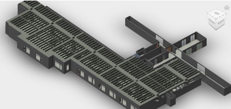
3D Laser Scan High School Campus
GPRS 3D laser scanned a Kansas high school for an architect. The building exterior, roof and main interior corridors were 3D laser scanned to reality capture the architectural features, exposed structural features and location of mechanical equipment on the roof. Educators, students, and community members developed a strategic plan to improve the high school experience, tasking the architect with a massive redesign to the existing school.
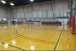
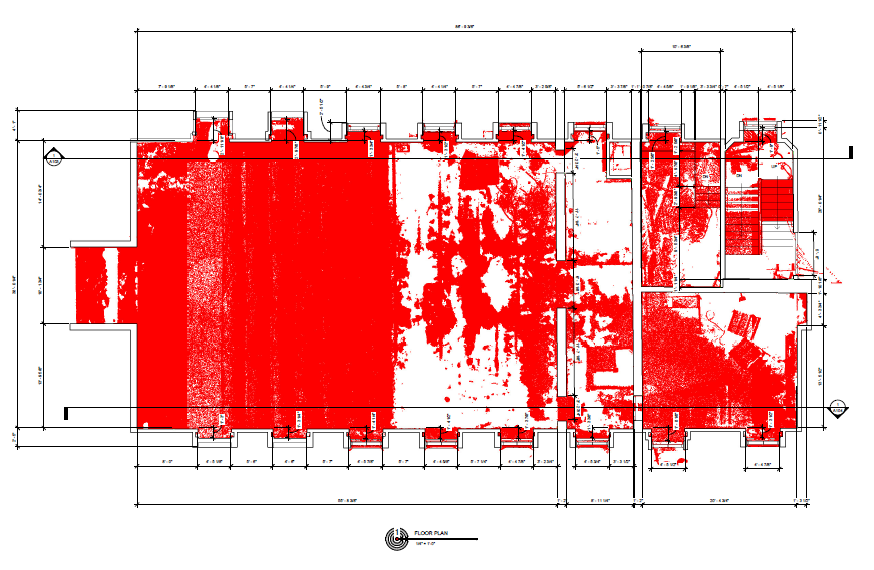
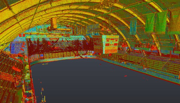
MIT Rockwell Cage
GPRS 3D laser scanned the MIT Rockwell Cage, home to the men's and women's basketball teams and volleyball teams. The primary objective was capturing 3D laser scan data from the interior gym floor to generate a 2D floor plan with spot elevation callouts.
Lehigh University 2D Site Plans
GPRS captured 3D laser scan data from several interior areas at Lehigh University to create a 3D BIM model and 2D site plans of a 2nd floor lecture hall, mezzanine and staircase.
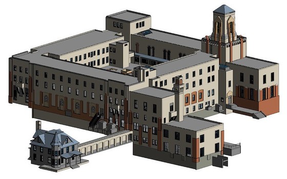
The University of Kentucky Hospital
GPRS performed 3D laser scanning services for the University of Kentucky Hospital in Lexington. The 3rd floor was laser scanned in a demo or shell state, capturing all structural, architectural and MEP features. A 3D model was generated for the client.
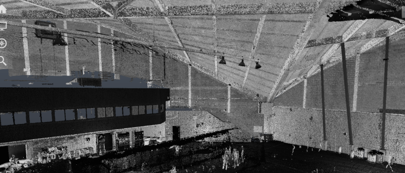
University of Vermont Gutterson Fieldhouse
GPRS captured 3D laser scan data from the ground floor of the University of Vermont Gutterson Fieldhouse and delivered point cloud files to the client.
University of Georgia Residence Hall
GPRS 3D laser scanned the existing conditions of a University of Georgia Residence Hall post demo and prior to renovation. Point cloud files were provided to the client. The residence hall renovation project included reconfiguring all living, bathroom and programmatic spaces, and incorporated several design components students requested—such as increased privacy in community bathrooms and in-room temperature control.
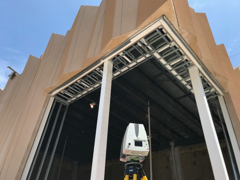
University of Wisconsin Music Hall
GPRS provided laser scanning services to determine the rough opening for clerestory windows at the University of Wisconsin Music Performance Hall. New aluminum windows were being prefabricated and installed. Additional areas for 3D laser scanning included the main floor space, and interior and exterior elevations including the mezzanine beams and ceiling. Point cloud files, TruViews, 2D elevation drawings and an LOD 200 3D model were delivered to the client.
University of Alabama Apartment Complex
Using the Leica P50 ScanStation, GPRS 3D laser scanned the exterior facade and one floor of a new apartment complex at the University of Alabama to perform a plumb analysis on the concrete columns. A point cloud file was delivered to the client.
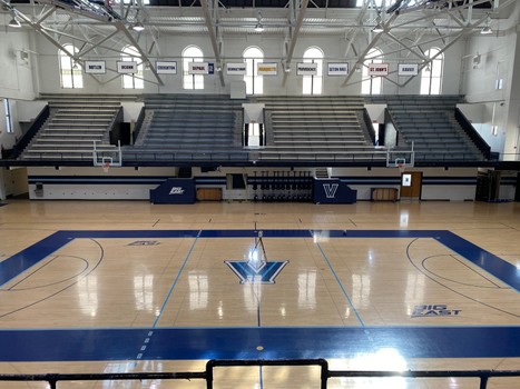
Villanova University Finneran Pavilion
GPRS provided 3d laser scanning services for Villanova's Finneran Pavilion, creating 2D drawings and a 3D model to be used in the University’s building renovation. GPRS provided intensity map point cloud files, TruViews, 2D drawings of the main floor and mezzanine and an LOD 200 3D model of HVAC and mechanical rooms.
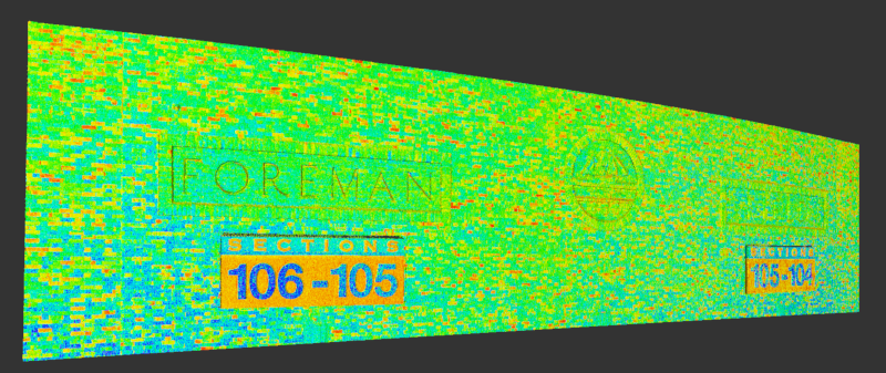
Old Dominion University Foreman Field
Old Dominion University planned to renovate Foreman Field because the existing structure could not be updated to meet modern building codes. GPRS provided intensity map point cloud files and TruViews for the decorative brick structures throughout the stadium.
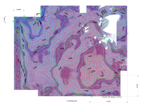
Northwestern Memorial Hospital Operating Room Floor Contours
GPRS 3D laser scanned eight (8) operating rooms and adjacent hospital corridors to capture the existing floor conditions, specifically elevation and perimeter of the operating rooms. Point cloud data, TruViews and 2D Floor Contour Analysis drawings were provided to the client.
University of North Carolina Wilmington Mechanical Room
GPRS performed point clouds scanning for a 2,880 square-foot mechanical room on the campus of UNC Wilmington. Point cloud data was delivered on the existing MEP. The target objects of data acquisition were the windows, doors, walls, beams, piping and chillers.
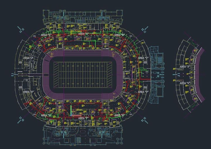
Notre Dame Stadium GPR Markings
GPRS 3D laser scanned ground penetrating radar (GPR) markings locating underground utilities at Notre Dame stadium. Our experienced technicians laser scanned and photographed over 160,000 square feet of space showing active conduit, water and sanitary sewer lines inside the stadium concourse.
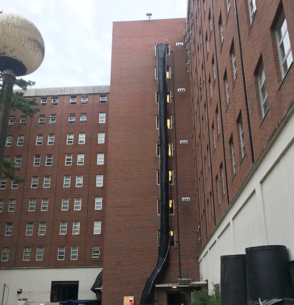
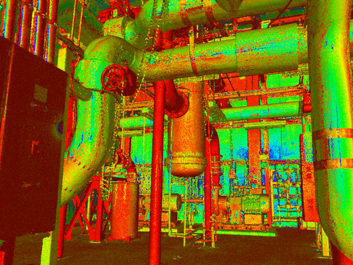
University of Michigan Underground Tunnel System
GPRS 3D laser scanned a 250' underground tunnel at the University of Michigan and created a 3D CAD model in .dwg format to include the outside diameter of piping (including insulation), cabling over ½", cable tray, piping support structure (including where possible: hangers, guides, rollers, limit stops and anchors), and cracks in concrete larger than ¼" to ½" in width.
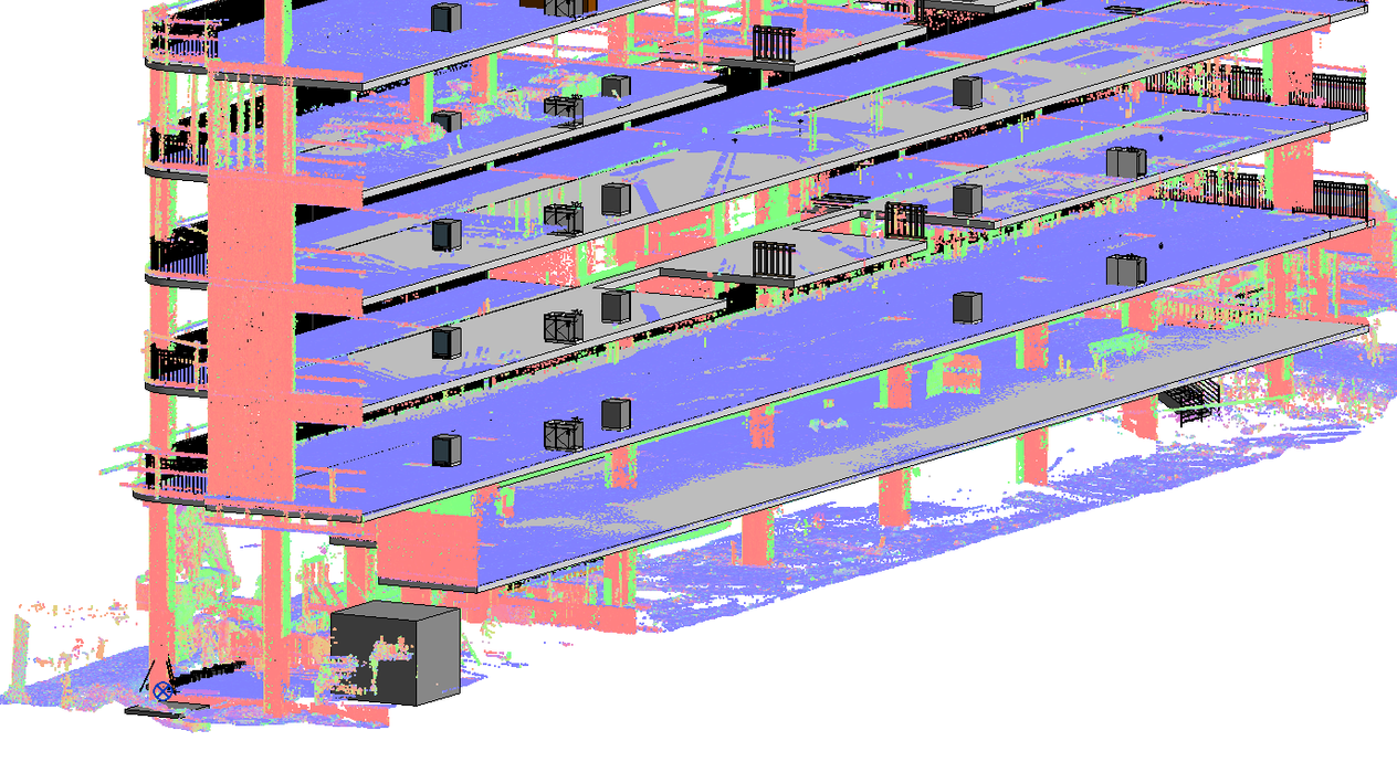
Ford Motor Company Robotics Building, University of Michigan
The Ford Motor Company Robotics Building, on the North Campus of the University of Michigan, was under construction. GPRS was tasked with capturing detailed point cloud data to create an LOD 200 3D model for three separate stairwells. The client was fabricating metal handrails that were to be installed on the staircases within the building after the steps and landings had been constructed.
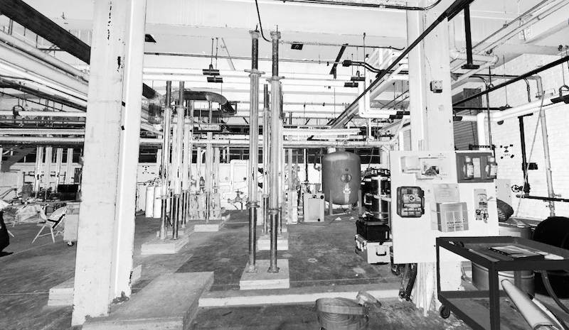
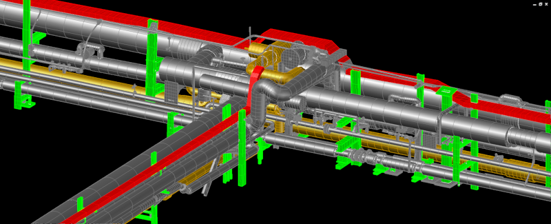
3D BIM Scanning at Eastern Michigan University Boiler House
GPRS provided laser scanning services for our client to plan modifications for a new boiler system. This boiler system was located in a Heating Plant on Eastern Michigan University in Ypsilanti, Michigan and produces half of the electricity consumed on campus. GPRS’s scan technician captured the structural features, equipment and MEP features of the operating floor, basement, mezzanine, roof and exterior façade. GPRS CAD technicians delivered a point cloud file to plan modifications and avoid piping interferences.
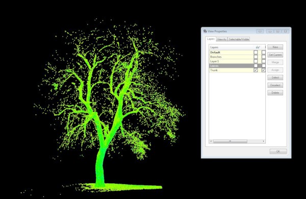
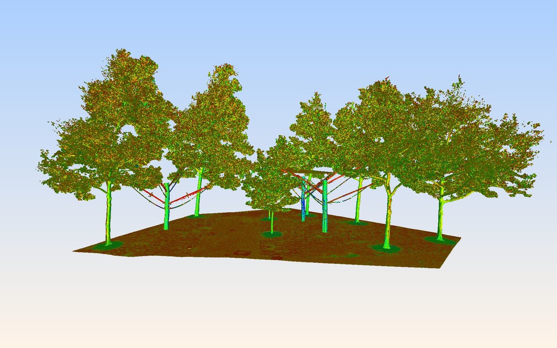
The University of Boulder TREExOFFICE
GPRS 3D laser scanned the trunk and limbs of an existing tree in Boulder, Colorado. Architecture students at the University of Colorado used laser scan technology to design TREExOFFICE, an outdoor workspace built around an American Linden tree in a park on campus. The space offers a conference table, six desks, WIFI, and a platform for people to work, sit, think, converse, speak, or perform. GPRS created a 3D mesh of the tree to aid in the cutting-edge design and prefabrication of the office space.
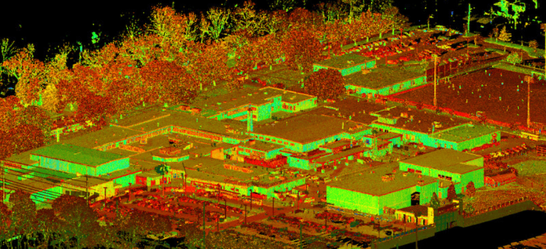
University of Chicago Courtyard
GPRS 3D laser scanned a University of Chicago campus courtyard for surface topography, plus the architectural and structural elements of exterior buildings visible in courtyard area. Point cloud (.rcs files) were delivered to the client.
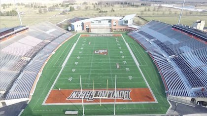
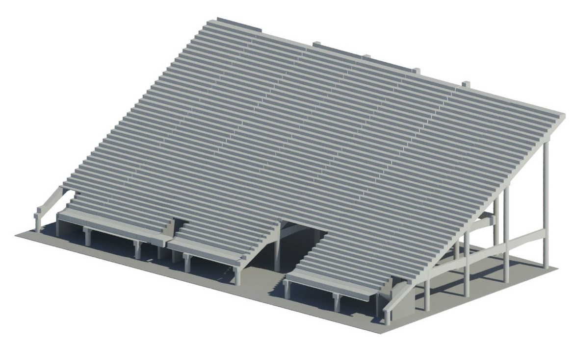
Bowling Green State University Football Stadium
GPRS provided 3D laser scanning and drone services for the Bowling Green State University football stadium, seating and concrete steps prior to beginning construction. GPRS provided TruViews to the client, which can be utilized to virtually visit the site without the need for expensive software.
University of Delaware Whitney Athletic Center
GPRS 3D laser scanned the University of Delaware Whitney Athletic Center stadium stand area to generate an LOD 200 AutoCAD structural model. This included structural elements such as exposed columns and beams and architectural elements including concrete structure, seats rows, and stairs, etc. They needed a volumetric survey of the raker beams and concrete steps. The grandstand extended 48,000 SF and rose 100' above the field surface.
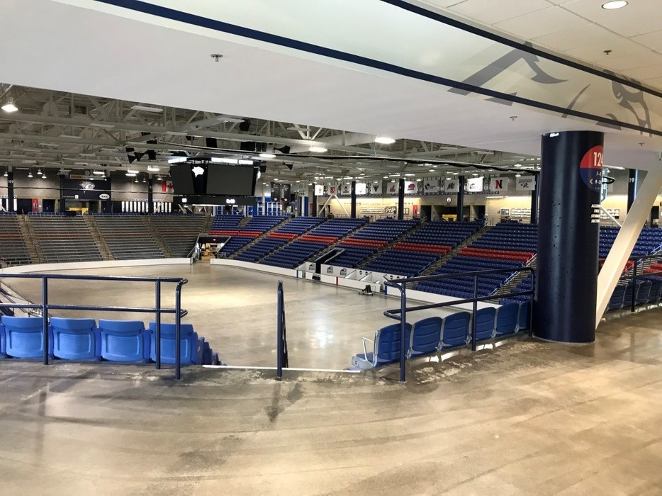
University of New Hampshire Whittemore Center Arena
GPRS captured 3D laser scan data from the interior of the 45,000 SF Whittemore Center Hockey Arena to generate a 3D AutoCAD model and 2D drawings of the concrete seating risers. The target objects of data acquisition were structural elements including exposed concrete seating risers and architectural elements including floors, walls and ceilings.
MIT Department of Earth, Atmospheric and Planetary Science Building
GPRS performed an as built survery of the interior and exterior of MIT Department of Earth, Atmospheric and Planetary Science Building (Green Building 54) in order to generate a 3D point cloud.
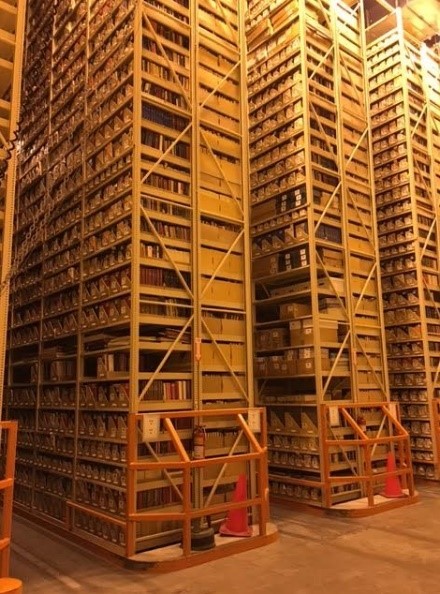
The Ohio State University Book Depository Floor Flatness
GPRS 3D laser scanned The Ohio State University’s Book Depository (approx. 10,000 SF) to capture the floor features, walls and shelving for plumb analysis. Point cloud files, TruViews and 2D drawings were delivered to the client.
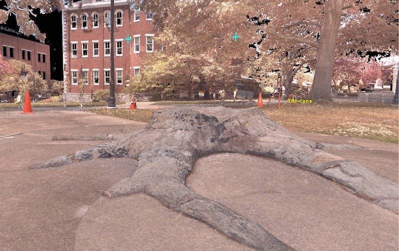
The University of Kentucky Whitfield Stump
GPRS was selected by the University of Kentucky to 3D laser scan The Whitfield Stump, a three hundred-million-year-old preserved stump of a lycopod tree. The University was moving this 7,000-pound fossil from one area of campus to another. The client requested TruViews and post processing of the point cloud data to create a mesh file.
Harvard University Sculpture
GPRS captured 3D laser scan data from 3 exterior, aluminum and canvas sunshade structures at Harvard University in order to generate OBJ Mesh Models.
Contact Us Today
Our team's expertise and attention to detail delivers accurate site data and intelligent models for every project. Having as-built data in a digital platform helps clients to better plan their project, eliminate risk and create accurate project timelines.
3D Laser Scanning Pricing
The cost of 3D laser scanning can vary widely depending on your project scope. GPRS customizes every quote specific to your project’s needs. GPRS Project Managers use 3D laser scanners to capture every detail of your site, delivering building dimensions, locations, and layout with millimeter accuracy. This can include the aboveground structural, architectural, and MEP features, plus underground utility and concrete markings. Our Mapping & Modeling Team can deliver point clouds, 2D CAD drawings, 3D BIM models, 3D Mesh models, TruViews, and Virtual Tours at any level of detail.