GPRS Laser Scanning Equipment
Equipment Used for Laser Scanning Data Capture
GPRS offers a wide range of laser scanning, photogrammetry, and visualization services. We work closely with each client to define the project scope and use the right tools to achieve the accuracy and deliverables needed to successfully complete each project. Beyond the point cloud data, we provide 2D CAD drawings, 3D BIM models, 3D meshes, and virtual tours to the highest quality standards. Projects are uploaded to easy-to use cloud-based data platforms, delivered via Sharefile or sent on a hard drive. GPRS uses the following equipment for laser scanning as-built data capture.
Our laser scan technicians are highly trained on the following equipment

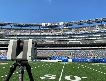
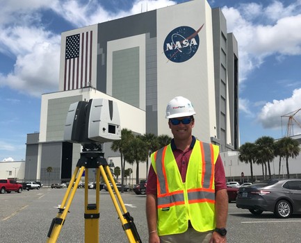
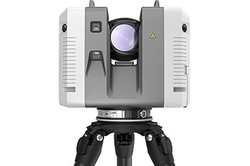
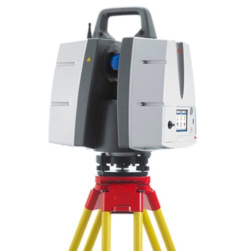
Leica P-Series: Long-range, highest level of detail, dual-axis compensator for level scans
- Leica P-Series ScanStations deliver the highest quality point cloud data and HDR imagery at an extremely fast scan rate of up to 1 million points per second and ranges of more than 1 kilometer. The P-series laser scanners can tie to survey control, achieve 2-4mm accuracy and have real-time liquid filled dual axis compensators to help mitigate movement and ensure level scans. With unsurpassed range, survey-grade accuracy, and low range noise, these scanners deliver highly detailed point clouds mapped in realistic clarity. Visit the Leica website for more information.
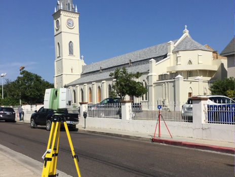
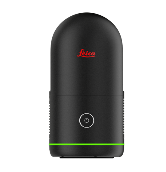
Leica RTC360: Fast, precise, in-field registration
- The Leica RTC360 3D laser scanner combines a high-performance laser scanner with Cyclone FIELD 360, a mobile-device app on a tablet computer, to capture and automatically pre-register scans in real time. With a measuring rate of up to 2 million data points per second and advanced HDR imaging system, you can have 3D colorized point clouds with 2-6 mm accuracy in under 2 minutes. Automatic targetless field registration (based on VIS technology) and the seamless transfer of data from site to office reduces time spent in the field, maximizing project productivity. Visit the Leica website for more information.

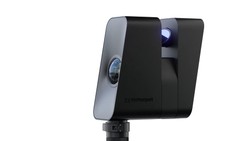
Leica BLK360: Small, lightweight reality capture with the push of a button
- The Leica BLK360 captures 360,000 points per second and features panoramic HDR imaging and thermal imaging capabilities. With a full range of 60m, it offers 4mm accuracy at 10m and 7mm accuracy at 20m. In 3 minutes, the Leica BLK360 can perform a full 360° data capture. The Leica BLK360 is compact, light and wireless and is ideal to quickly scan smaller projects. Visit the Leica website for more information.
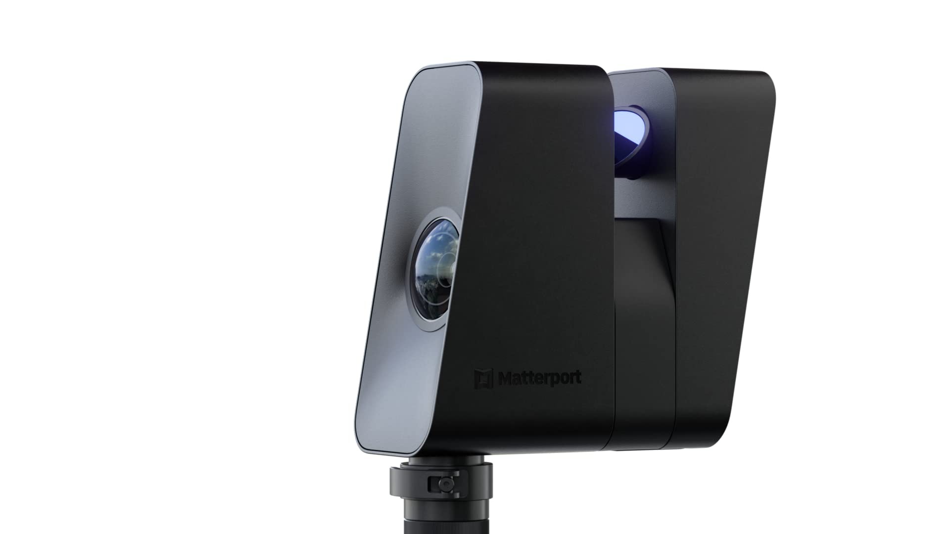
Matterport Pro 3: LiDAR and camera
Matterport Pro3 allows you to create virtual 3D models, point clouds, layouts, and floorplans of physical spaces, with the ability to edit and share them using the Matterport app and digital twin technology cloud service. The Matterport Pro3, updated with LiDAR-based scanning, offers 20mm accuracy within a 10m range, and has a maximum 100m scanning range. Data is collected at 100k points per second in under 20 seconds per sweep. The Matterport Pro3 features a custom 30-megapixel sensor and 12-element lens covering an ultra-wide angle to produce full-color digital twins. Visit the Matterport website for more information.
Laser Scanning Equipment Product Specifications
| Matterport Pro3 Camera | Leica BLK360 | Leica RTC360 Laser Scanner | Leica P50 Laser Scanner | |
|---|---|---|---|---|
|
|

|
|
|
| Overview | LiDAR and camera | Small, lightweight reality capture with the push of a button | Fast, precise, in-field registration | Long-range, highest level of detail, dual-axis compensator for level scans |
| Project Scope | Indoor and outdoor spaces | Indoor and outdoor spaces | Indoor and outdoor spaces | Indoor and outdoor spaces |
| 3D Point Accuracy | +/- 20mm @ 10m | 4mm @ 10m 7mm at 20m |
1.9 mm @ 10 m 2.9 mm @ 20 m 5.3 mm @ 40 m |
1.2 mm + 10ppm over full range (120 m / 270 m mode) 3 mm + 10ppm over full range (570 m / >1 km mode) |
| Range | 0.5m to 100m | 0.5m – 45m | 0.5m – 130m | 0.4m - 1 kilometer |
| Technology | LiDAR | Waveform Digitizing (WFD) technology | LiDAR | LiDAR |
| Depth Resolution | 100k points per second, 1.5M points per scan | up to 680k pts / sec | 2 million data points per second | 1 million data points per second |
| Capture Speed | 18 seconds per scan | 20 sec for complete full dome scan and spherical LDR image at 50mm | 2 mins for complete full dome scan and spherical HDR image at 6mm @ 10 m resolution | 2 minutes |
| Camera System | 2K sq. per skybox face, 7 exposures at normal dynamic range | 13 MP 4-camera system | 36 MP 3-camera system captures | 4MP per each 17°×17° color image; 700 MP for panoramic image |
Data Platforms for Laser Scanning Projects
3D laser scanning data platforms help clients visualize, extract, analyze, and share point cloud data. There are many platforms available to manage laser scan projects and scan-BIM workflows. GPRS uses the following data platforms:

Matterport
- Matterport is a 3D data platform trusted by thousands of businesses to securely store and manage 3D digital twins of their properties. The Matterport cloud service requires a separately obtained login and provides collaboration, and customization such as metadata tags, modeling file export, and editing tools. For more information, visit the Matterport website.

Cintoo Cloud
- Cintoo Cloud is a SaaS platform that make your laser scans fully cloud-compatible, shareable, distributable and enrichable with measurements and annotations. Cintoo Cloud is cloud connected to BIM 360, BIM Track, and Procore to enable QA/QC and issue tracking workflows when you need to compare your as-builds to your designs. Cintoo Cloud uses a unique core point cloud-to-mesh engine to bridge the gap between the physical and digital worlds. Accurate data of buildings, factories, plants, or any other asset, becomes accessible and easily interpretable, by experts and non-experts alike, from a simple web browser from anywhere at any time, using Cintoo’s 3D mesh streaming technology. For more information on Cintoo Cloud, click here.

BIM 360
- BIM 360 is an Autodesk cloud-based solution that allows project teams to effectively work in a collaborative environment. In the AEC industry, it connects all project stakeholders to execute projects from conceptual design through construction and ultimately project turnover. BIM 360 is the overarching concept that is comprised of various modules focusing on different aspects of the project lifecycle: (Docs, Build, Design, Coordinate, Layout, Plan and Ops). For more information on BIM 360, click here.
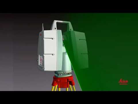
How a Laser Scanner Works by Leica Geosystems
For More Information
There are many factors to consider when using 3D laser scanning equipment and data platforms. Making an informed choice can ensure a successful project. Contact us today at 419-843-7226 or email Laser@gprsinc.com for more information. We’re currently offering 10-minute presentations – would you like to schedule one? Click here.