3D laser scan data will help to identify structural issues, deterioration, and other factors affecting The House of the Seven Gables historical site and deliver the architect 2D plans and a 3D BIM model to develop architectural designs for restoration.
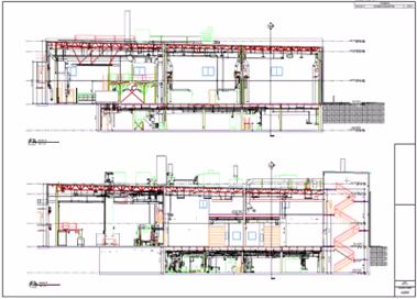
3D laser scan and model The House of the Seven Gables property in Salem, Massachusetts for historical preservation. The exterior shells of the Turner-Ingersoll Mansion (also known as The House of the Seven Gables), The Retire Beckett House, Hooper-Hathaway House, Nathanial Hawthorne Birthplace, Primm House, and features of the Seaside Colonial Revival Gardens were 3D laser scanned with the Leica RTC360, capturing highly detailed and accurate digital as-builts, to deliver 2D elevations and a 3D BIM model of each property to the architect.
3D laser scan data will help to identify structural issues, deterioration, and other factors affecting The House of the Seven Gables historical site and deliver the architect 2D plans and a 3D BIM model to develop architectural designs for restoration.
Highlights
THE BOTTOM LINE
3D laser scan data will help to identify structural issues, deterioration, and other factors affecting The House of the Seven Gables historical site and deliver the architect 2D plans and a 3D model to develop architectural designs for restoration. INDUSTRY
Historical Preservation SERVICE
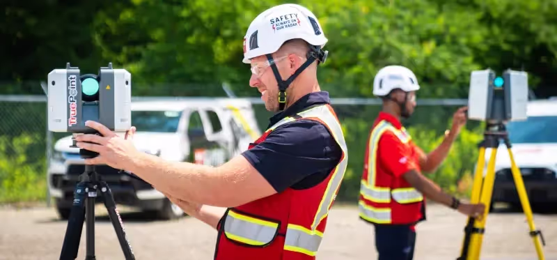
3D Laser Scanning; Mapping & Modeling LOCATION
Salem, Massachusetts PM Insight
The properties look well preserved from the outside, yet the historic site's preservation manager is aware of the the myriad ways climate change is threatening the integrity of the structures. Deliverables
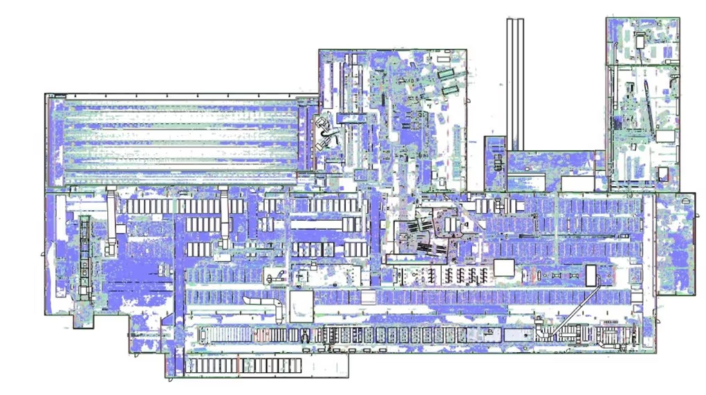
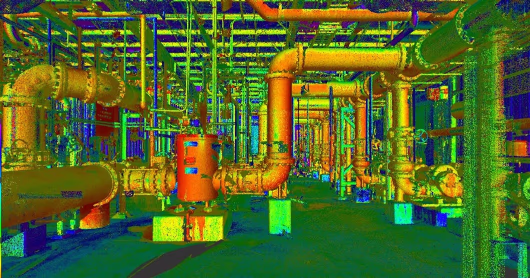
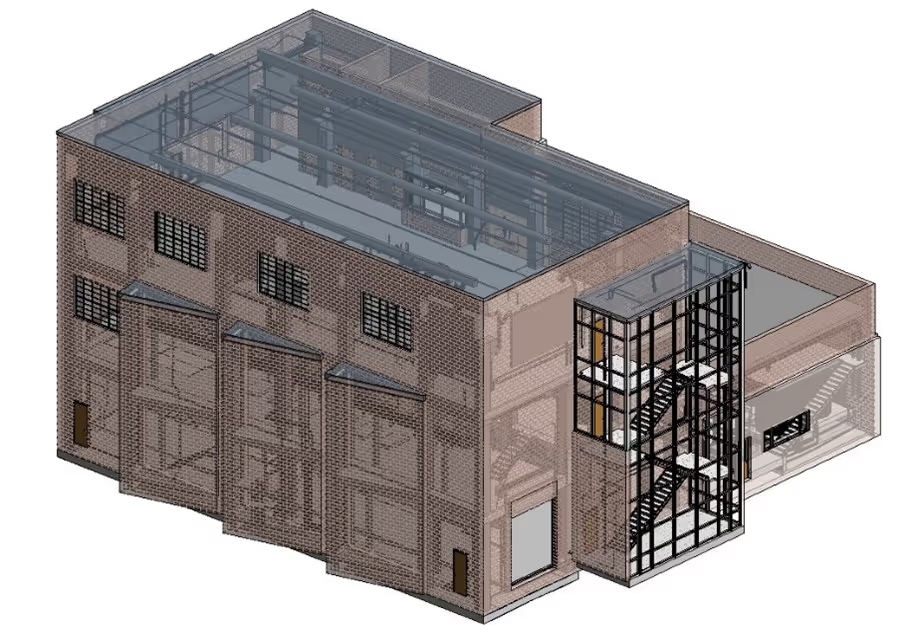
Point Cloud, 3D BIM Model, 2D CAD Elevations Task
3D laser scan and model The House of the Seven Gables property in Salem, Massachusetts for Union Studio Architects historical preservation. The exterior shells of the Turner-Ingersoll Mansion (also known as The House of the Seven Gables), The Retire Beckett House, Hooper-Hathaway House, Nathanial Hawthorne Birthplace, Primm House, and features of the Seaside Colonial Revival Gardens were 3D laser scanned with the Leica RTC360, capturing highly detailed and accurate digital as-builts, to deliver 2D elevations and a 3D BIM model of each property to the architect. PROBLEM
The House of the Seven Gables strives to preserve their historic buildings in the face of several challenges, including deterioration due to climate, weakening of the seawall, and mold in the basement of the Nathaniel Hawthorne Birthplace. As a National Historic Landmark District, the property is confined by preservation standards set by the federal government and the town of Salem. Because of these terms, unlike making renovations to a modern home, every modification at the Seven Gables property must be approved by multiple stakeholders to ensure that historical accuracy is maintained. The client also had budget constraints due to the project’s nonprofit status, so the job scope narrowed from 3D laser scanning eight buildings to five. Existing Conditions, a GPRS company, worked closely with Union Studio to efficiently supply them with the data and deliverables they required, knowing the allocated budget for this project. Solution
3D laser scanning will play an important role in the preservation of these historic buildings, by delivering as-built data, drawings, and models for design planning and decision making. 3D laser scanning documented the exterior building shells, delivering precise measurements and building footprints. For the Hooper Hathaway House basement, 3D laser scanning captured the architectural and structural features, geometry, and spatial layout. Benefits
3D laser scanning captured highly detailed and accurate digital measurements of The Gables’ buildings and infrastructure to create as-built drawings and 3D BIM models for this architectural preservation project. Union Studio Architects can reference accurate site data to create and share design plans with all project stakeholders.
All
3D Laser Scanning


.svg)


.svg)
.svg)
.svg)
.svg)
.svg)
.webp)