Point Clouds


GPRS Point Cloud Services
Point cloud data is transforming the way architecture, engineering, and construction projects are planned and managed, by providing accurate as-built information to all team members, including contractors, engineers, architects, and operations managers.
A point cloud is the starting point of reality capture, as-builts, and scan-to-BIM – it is a virtual 3D dataset of existing site conditions, which can be processed into 3D BIM models, 3D meshes, and 2D CAD drawings of any building or site.
At GPRS, we use industry-leading Leica survey-grade laser scanners and 3D photogrammetry to capture comprehensive point cloud data with 2-6 millimeter accuracy. The data produced is complete, clean, accurate, and well filtered with low range noise. Our Mapping & Modeling Team transforms point clouds into 2D CAD drawings, 3D BIM models, 3D meshes, TruViews, and virtual tours of the highest quality standards. Partnering with GPRS delivers your company accurate as-built data to expedite project planning and reduce change orders, delays, and costs.
Point clouds deliver highly accurate digital measurements of assets for use in construction and engineering projects.
What is a point cloud?
A point cloud is a set of data points captured by the laser scanner in a 3D coordinate system—commonly known as the XYZ axes. Each point represents a single spatial measurement on an object's surface. Taken together, a point cloud captures every visible detail of the project site. These include objects like doors, windows, walls, MEP equipment, ductwork, and structural steel, to name a few. You can generate a point cloud with a LiDAR-based scanner, 3D photogrammetry, or a mobile mapping device.
Clients can import the point cloud into CAD or BIM software to visualize the area. The data will look like a pixelated, digital version of your site. Once imported, it can be parsed, manipulated, and modified to aid in visualization, design, engineering, and construction projects. Clients can utilize the raw point cloud data, or convert it into 3D solid models, 3D meshes, and 2D drawings.
What format are point clouds delivered in?
GPRS will deliver .PTG or .E57 point cloud files and Autodesk Recap files in .RCS and .RCP format. Our Mapping & Modeling Team can transform point clouds into 2D CAD drawings, 3D BIM models, 3D meshes, TruViews, and virtual tours at any level of detail.
How do you create a point cloud?
- To create a point cloud, GPRS 3D laser scans a site from varying viewpoints. Millions of data points are captured and processed into a point cloud, creating an accurate data set of a structure or site. Every GPRS Project Manager completes an extensive training program to ensure their competence in laser scanning equipment and field knowledge to provide the best possible results for every project.
Why is a point cloud important?
Point clouds deliver highly accurate digital measurements of assets for use in construction and engineering projects. By representing spatial data as a collection of coordinates, point clouds deliver large datasets that can be mined for information. The visualization and analysis from point cloud data is invaluable for decision making.
How do you process a point cloud?
Registration is the process of compiling individual scans into a cohesive point cloud. It involves taking the raw scan data collected onsite and “stitching it together” to produce a complete 3D composite point cloud of the existing conditions. Getting the registration right ensures the most accurate measurements, and precise 2D drawings and 3D models. This is an important part of the GPRS 3D laser scanning process, and it must be completed by an experienced individual. Once complete, the registered point cloud provides accurate documentation of the as-built space with 2-6 millimeter accuracy.
What is a point cloud used for?
Point clouds provide powerful and dynamic as-built information for a project. Point clouds are used in architecture, engineering, and construction to create accurate 3D BIM models of buildings and other structures. GPRS can create a Building Information Model (BIM) of an existing structure or update original design models with real-world conditions.
When working on retrofit design projects, our clients can experience a virtual site and check for conflicts with the existing conditions. This helps stop critical errors in their tracks before they slow or halt a project.
How long does it take to create a point cloud?
GPRS 3D laser scans most projects in a couple of hours, or larger campuses in a few days. After the scan is complete, the data is sent to the Mapping & Modeling team to be registered and will then be uploaded to the client. This process can take 2-3 days.
Can a point cloud be created in color?
Point cloud data can be captured in intensity (RGB), greyscale (black and white) and full color. Color point clouds combine the benefits of a photo (or photogrammetry) with the precision of laser scanning. To complete a full color laser scan, the building or site must have good lighting.
What are the applications of point cloud data?
Point cloud data has become the new standard in design planning for the architecture, engineering, and construction industry. Having a virtual model of the project gives companies the ability to effectively plan, design, construct, and manage projects. Point cloud data aids in analysis, design, construction, renovation, prefabrication, asset management, and facility modifications, to name a few. Precise point clouds expedite design planning and reduce project costs and change orders.
Samples of Point Cloud Data

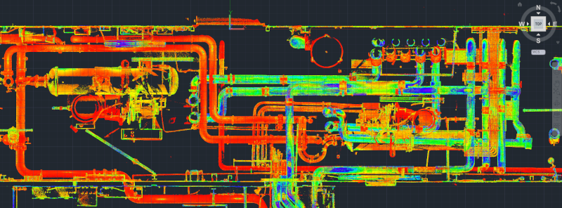
Point cloud of a new construction building MEP fit out.
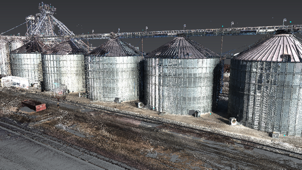
Point cloud of an apartment complex.
Point cloud and 3D model of a sustainable products company.
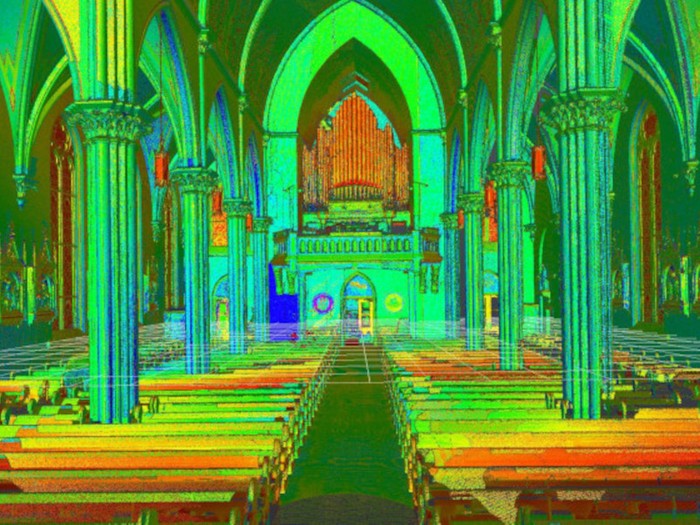
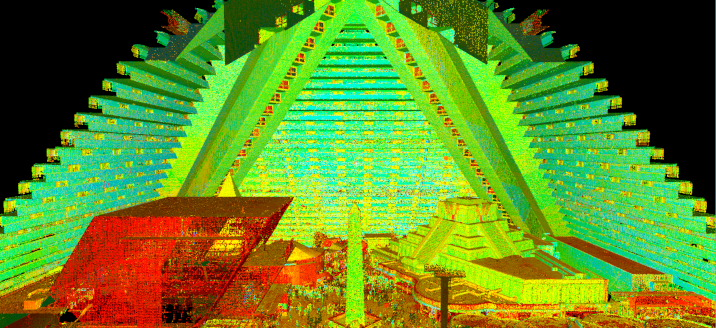
Colorized point cloud of a church.
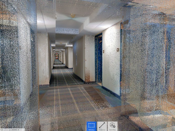
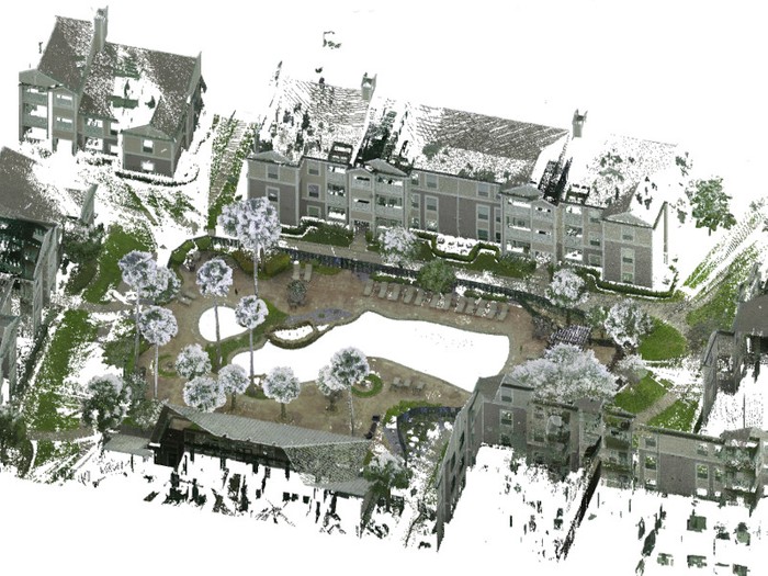
Colorized point cloud of a hotel interior.

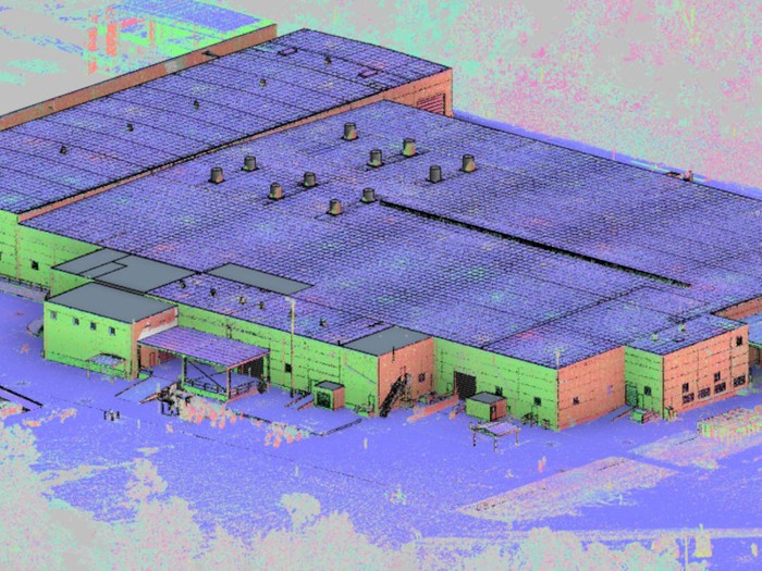
Colorized point cloud of a manufacturing facility.
Why GPRS? The GPRS Difference
With GPRS, clients can rest assured that our elite Project Managers use state-of-the-art 3D laser scanning and photogrammetry technology to document accurate existing conditions information. GPRS leads the industry – providing outstanding service – keeping projects on time, reducing risks, and putting relationships with our clients first.
For more information on point clouds, call 419-843-7226 or email laser@gprsinc.com. We’re currently offering 10-minute presentations – would you like to schedule one? Click here.