Newsletter September 2017

From the Desk of Ryan Hacker:
FOR IMMEDIATE RELEASE!
TruePoint Aids in Plant Documentation
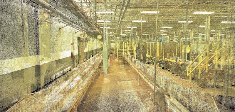
“Plant environments are alive with change as companies upgrade existing installations, maintain equipment, and add new machinery to leverage the latest technology,” according to Bruce Bowditch of Leica Geosystems. 3D laser scanning can accurately capture existing conditions and prove to be invaluable. TruePoint was featured in a recent article by Leica Geosystems documenting this value.
A well-documented plant can expedite design and upgrades, while minimizing clashes, field rework and delays. 3D laser scanning also permits the remote viewing and evaluation of facilities. Essentially, laser scan documentation serves as a facility map, enabling employees to discover the quickest, easiest path to:
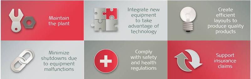
*Image courtesy of Leica Geosystems, Inc.
Tape Measuring Documentation Methods Don’t Measure Up
When measurements are taken with traditional methods, crucial information can be missed and measurements can be inaccurate. Laser scanning can collect a vast amount of data in a minimal amount of time. Facilities would have to rent lifts to access some of the higher locations, causing safety concerns and prompting the need for additional Occupational Safety and Health Administration (OSHA) training. Laser scan data collection can be captured safely from the ground with no disruption to operations.
Laser Scanning Transforms Weeks of Data Collection into Days
A power plant in Wyoming needed to capture the as-is conditions for pre-planning, fabrication, and clash detection for the addition of a new system. Collecting the data manually to help avoid clashes seemed almost impossible. The space they were modifying was dominated by a complex gridlock of steel and many of the key features of the new system needed to be located above the steel support structure. TruePoint introduced laser scanning technology to answer their challenge. To complete the same job using traditional measuring devices would have taken six people about three weeks, TruePoint completed the job in 3 days.
Data was imported into Leica Cyclone, point clouds were registered, and engineers were provided with files in Autodesk format (PCGs) for use in their modeling software. In addition, TruePoint provided Leica TruViews, dimensional photographs overlaid on top of the point cloud data. Since the engineering firm handling the project was based in a different state, the Leica TruViews helped to familiarize them with the scan area and allowed them to return to the plant virtually as needed without traveling physically to the site. This allowed them to provide a much faster turnaround on deliverables for the plant. Within three days of receiving the data, the engineers had already found some major clashes with their structural steel, which more than offset the scanning costs.
Reduce Costs and Risk with Laser Scanning
Engaging in laser scanning to analyze plant specifications can meet project deadlines and lower risks, clashes and field rework, ultimately reducing costs. TruePoint can quickly and accurately create a point cloud of the laser scan area and easily convert that point cloud to a 3D CAD model.
Contact us for a FREE laser scanning demonstration at info@truepointscanning.com or call 419-843-7226.
Featured Case Study:
3D Laser Scanning Aids Manufacturing Facility
TruePoint Laser Scanning was selected to 3D laser scan a manufacturing facility production line in Houston, Texas. The client needed to capture as-built conditions of the conveyor and belt system where the product was bottled, labeled and packaged to make upgrades to the line. TruePoint created colorized point clouds (.ptg file format) indexed in Recap (.rcs files) for the client. The client could then incorporate the aligned point clouds into their design model to make sure the new belt system fit properly and there were no clashes.