What is LiDAR and How Does It Work?
What is LiDAR?
LiDAR, short for light detection and ranging, is a remote sensing technology that uses light in the form of a pulsed laser to measure distances to a target. A LiDAR sensor sends out beams of laser light in all directions and then measures how long it takes for them to return back to the sensor. The distance is then calculated using the velocity of light. The velocity, or speed of light, is 299,792,458 meters per second. These are known as time-of-flight measurements. Time-of-flight measurements can be used to record data for distances up to 1 kilometer.
How Does LiDAR Work?
Using ultraviolet, visible, or near-infrared light, LiDAR maps spatial relationships and shapes by measuring the time it takes for signals to bounce off objects and return back to the sensor. Each of these is recorded in a laser scan. Each individual scan is made up of millions of three-dimensional data points. Note that each scan is limited to line-of-sight, so multiple scans are needed to provide a comprehensive 3D view of an object or scan area. Entire buildings or campuses will require laser scanners placed in multiple positions around a site to take individual scans from varying viewpoints.
What is LiDAR Used For?
The technology is deployed to collect highly accurate digital measurements and images used to create 3D models and 2D maps of objects and environments for construction and engineering projects. LiDAR technology is fast, accurate, and reliable.
Why 3D Scan with LiDAR?
3D terrestrial scanners are the most accurate form of LiDAR. 3D scanners capture millions of three-dimensional data points, documenting the accurate existing conditions of a structure or site. Data points are processed into a 3D visualization known as a point cloud. Point clouds are the set of X, Y, and Z geometric coordinates of a scanned space. The technology enables users to produce highly accurate digital measurements and images quickly and easily.
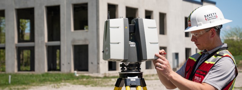
What is Terrestrial Laser Scanning?
Terrestrial laser scanning is a form of measuring with a tripod-based LiDAR instrument used to capture high accuracy data of buildings and other objects. Terrestrial laser scanning is used to capture existing structure, equipment, utilities, and processes to plan for construction, relocation, modernization, and enhancements.
Why Does the Construction Industry Use LiDAR?
The construction industry is primarily using LiDAR to produce data sets of accurate and efficient as-built conditions of existing space or object. The data can be used as a point cloud, or used to create 3D models for varying purposes. 3D Building Information Models (BIM) give contractors and engineers the ability to effectively plan, design, construct and manage projects. They can even be used for facility management and digital twin purposes.
LiDAR Can Be Used in Every Stage of the Construction Process:
- As-Builts: Before starting a construction project, an as-built visualization of the structure should be completed to capture exact building dimensions, locations and layout – information that is crucial to the success of any project.
- 3D BIM Modeling: 3D BIM (building information modeling) models are digital representations of a building or site to facilitate design, construction, and operational processes. 3D BIM models provide users with the ability to break down architectural, structural, and MEP building features and see how they fit into a single finalized structure or assign attributes that give them intelligence of their function.
- Clash Detection and Prefabrication: LiDAR data helps to identify potential clashes, fabricate components, and plan a flawless installation. LiDAR data saves time, money, and headaches by preventing costly modifications in the field.
- Structural Analysis: LiDAR is used to analyze the existing building structure. Structural defects can be identified and remedied.
- Construction Monitoring: The construction process can be monitored with LiDAR to determine discrepancies from plan to as-built.
- Collaboration and Coordination: Project managers, architects, and engineers can share LiDAR data with their teams to ensure everyone is on the same page and can coordinate their work effectively.
LiDAR Scanning Technology Explained
This pulsed laser technology has many applications for construction and engineering, providing detailed building information. With LiDAR technology, you can rest assured the data is accurate.
LiDAR and 3D laser scan technology requires technical knowledge and experience in data capture. Contact TruePoint Laser Scanning today before beginning your construction or engineering project at 419-843-7226 or email info@truepointscanning.com.