
TruePoint Uses NavVis VLX to Capture As-Built and HD Photos in State-of-the-Art Doctor’s Office
Location: Birmingham, AL
NavVis VLX wearable mobile mapping system was used in a newly constructed office for fast reality capture.
Key Takeaways:
- TruePoint captured the interior with a NavVis VLX mapping instrument, which provided a fast scanning workflow and easy capture of HD color imagery
- The team used a hybrid scanning approach and captured the building exterior with the Leica RTC360 3D Laser Scanner
- Scanning the 3,500 sq ft asset took just over 2.5 hours—one 30-minute scan with NavVis VLX, and 2 hours of scanning with the Leica RTC360 3D Laser Scanner
- While walking through the building to scan with NavVis VLX, the specialist manually snapped 40+ color HD panoramic photos
- TruePoint generated highly detailed as-built documentation for their client’s new office, as well as colorful HD imagery for use in marketing materials
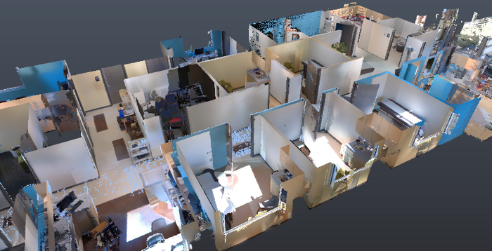
- NavVis IndoorViewer gives the client and any future stakeholders remote access to the digital assets – (point clouds and panoramic imagery) completely independent of their location – from any smartphone, tablet or laptop
A (Chronic) Pain Point
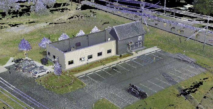
An internal medicine practice near Birmingham, Alabama, US commissioned a state-of-the-art 3,500 sq ft office. The architect designed the building in 2D CAD software, and the drawings were used extensively by multiple trades throughout the building process.
So far so good, but here’s the problem: The client needed more information than the 2D drawings could offer. They needed a colorized, accurate 3D data set, which would reflect all architectural and structural elements, as well as the floor plan as it was actually built. They needed this data set for a wide variety of high-value tasks, including arranging on-going facilities maintenance and operations, and planning future additions and renovations.
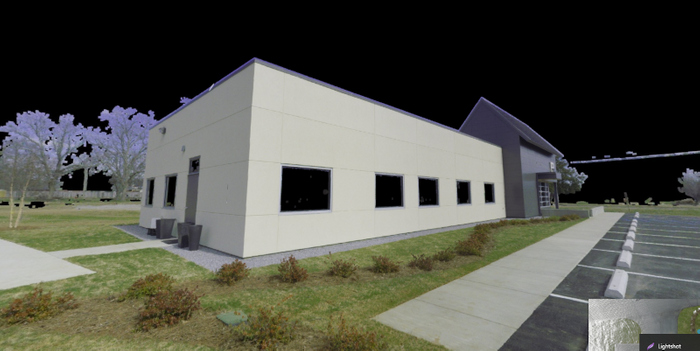
On top of that, the client had one more request. They needed the 3D data set to be colorized and include hi-definition color photos crisp enough to use in their marketing materials.
What the Doctor Ordered
The client hired the talented crew at TruePoint Scanning to capture these digital assets. TruePoint’s regional manager for the southeast, Andy Foshee, says the team attacked the project with a hybrid approach. They captured the interior using NavVis VLX, a wearable mobile mapping system that allowed them to scan as they walked. Then, they captured the building exterior using the Leica RTC360 3D Laser Scanner. At the end of the workflow, they registered the data sets together to produce a single point cloud.
Foshee says one of the primary reasons TruePoint picked NavVis VLX for this project is the ease of capturing the HD imagery the client required. “With NavVis VLX, you’re already walking through the areas you want to capture,” says Foshee, “and you can just press a button to take your HD photos manually. That means we could pick and choose where in the building to snap and get the images the client needed.”
A Short Appointment
Since NavVis VLX offers the ability to scan on the move, this means it offered our client another benefit: speed. “We had to scan the building off hours so we wouldn’t interfere with normal business operations,” says Foshee. “But since NavVis VLX collects data faster than other scanners, this wasn’t a problem. We were able to capture the 3,500 sq ft office in one evening shift—I was finished with the interior in about 30 minutes, and the rest within 2 hours. The whole workflow is shorter, and this got us off site sooner,” he adds. “I’d say that, on average, NavVis VLX cut our time on site by 50%.”
Prognosis: Excellent
In the end, TruePoint delivered a single colorized point cloud and 40 HD images for the 3,500 sq ft office. The company uploaded all of these digital assets to NavVis IndoorViewer for easy access from any standard web browser on a computer, tablet, or phone. This will enable stakeholders to download the point cloud data and imagery as needed for use in offline CAD or BIM platforms on future projects. TruePoint also used IndoorViewer to distribute the HD images to the client.
“Our client was very impressed with the 3D data and imagery we provided,” says Foshee. “They are very excited about the 3D data and using the HD images in their marketing materials. Would this project have been possible without NavVis VLX?” Foshee asks. “Yes—but the device’s ease of use, the ability to scan faster, and the ability to capture colorized HD photos made the whole process much easier.”
TruePoint Laser Scanning is a nationally recognized leader in the laser scanning industry providing 3D laser scanning and scan to BIM services. Our experienced professionals are dedicated to delivering the highest quality point cloud data, as-built drawings and 3D models, using state-of-the-art equipment, technology and processes. TruePoint Laser Scanning provides AEC professionals the insight and tools to more efficiently plan, design, construct and manage buildings and infrastructure.
For 3D laser scanning services in Birmingham call 205-600-0989 or email birmingham@truepointscanning.com.
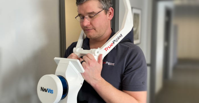
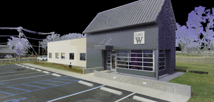
TruePoint uses NavVis VLX to capture as-built of Doctor's Office.
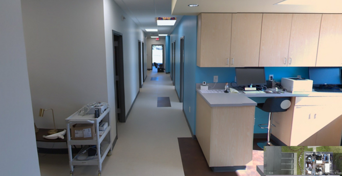
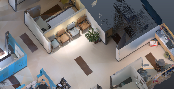
Dr. Office Interior NavVis IndoorViewer screenshot.
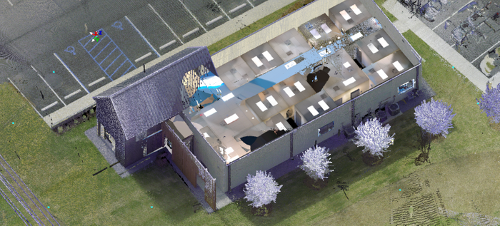
NavVis & RTC data shown in Leica Cyclone point cloud processing software.
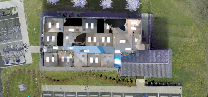
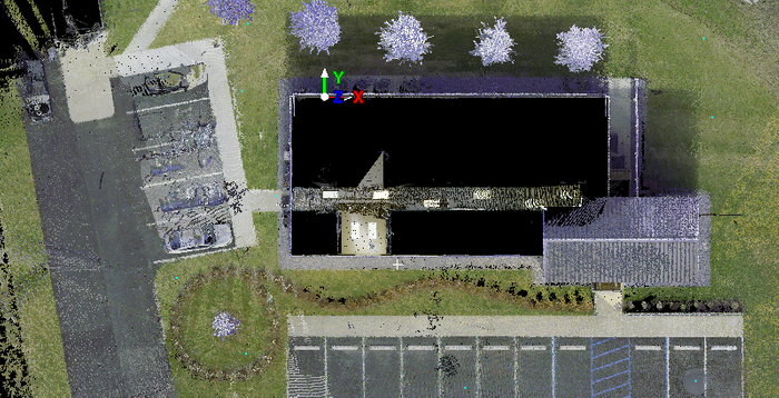
NavVis and RTC in Cyclone point cloud data in plan view.
RTC 360 point cloud data screenshot.
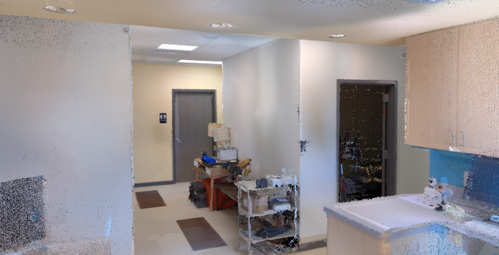
Autodesk ReCap closeup screen capture.
Enlarged view in ReCap.
Building exterior screencapture
Office waiting area NavVis IndoorViewer screen capture.
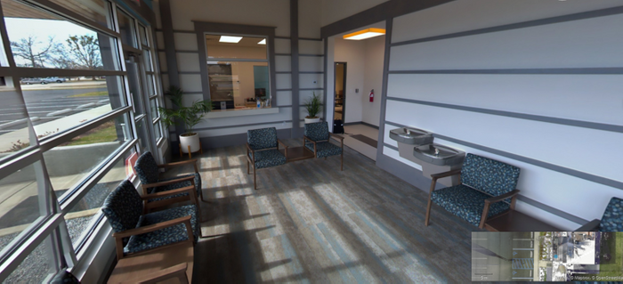
Waiting area NavVis IndoorViewer screen capture.
Leica RTC 360 top view.
NAVISWORKS Cloud screen capture.
Case Study Written by Sean Higgins for NavVis
Sean Higgins is an independent technology writer, former trade publication editor, and outdoors enthusiast. He believes that clear, buzzword-free writing about 3D technologies is a public service.
Topics: Laser Scanning, Reality Capture, Scanning Device, Indoor Mapping, Mobile Mapping
