TruViews or 3D photographs will aid the client in re-creation of as-is conditions at the alternative location.
Case Study: Laser Scan Existing Conditions to Create Mesh File
Location: Lexington, Kentucky
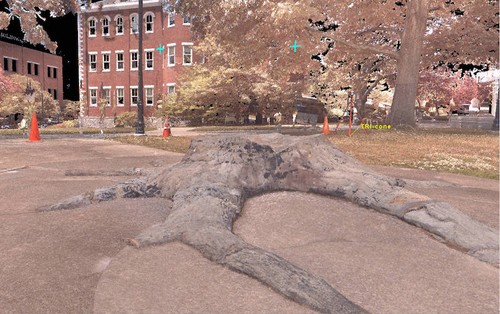
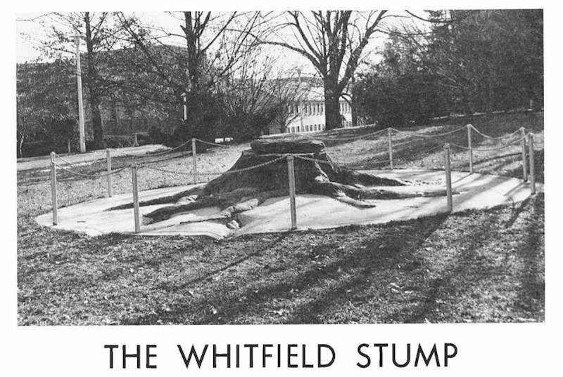
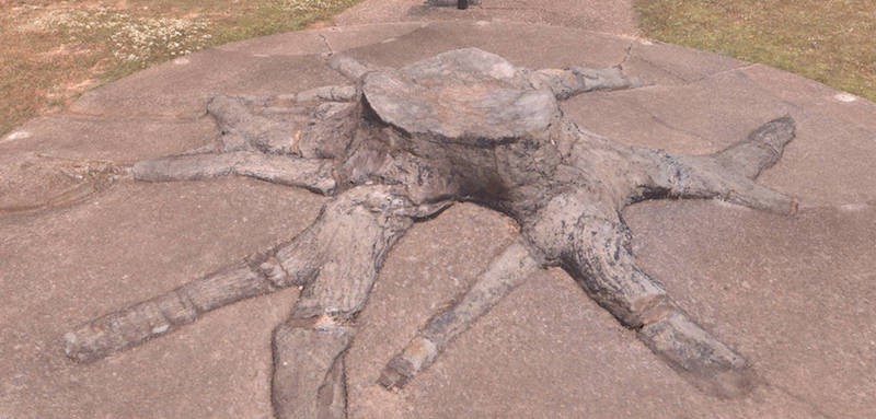
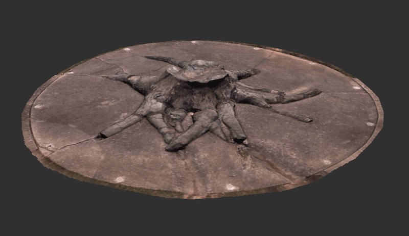
Task: TruePoint was selected by the University of Kentucky to 3D laser scan The Whitfield Stump, a three hundred-million-year-old preserved stump of a lycopod tree. The University was moving this 7,000-pound fossil from one area of campus to another. The client requested TruViews and post processing of the point cloud data to create a mesh file.
Challenge: The client wanted to 3D laser scan the fossil and the environment to recreate like conditions after its relocation. It was important to survey the existing conditions without damaging the 300,000,000-year-old fossil.
Solutions: TruePoint’s laser scan technician used the Leica ScanStation P40 to reality capture the environment. In just a few hours on site, the entire area was accurately laser scanned without disturbing the three hundred-million-year-old stump. The TruViews and mesh will aid the client in re-creation of as-is conditions at the alternative location.
Deliverables: TruePoint in-house engineers delivered a Recap file (.rcp file), TruView and 3D mesh (.stl, .obj, .ply). A high poly mesh with over 1.6 million faces in both OBJ and PLY formats and a low poly mesh with over 500,000 million faces in both OBJ and PLY formats faces was created for the client.
Added Value: Accurate 3D measurements were captured in a fast and environmentally friendly manner. Laser scanners are non-contact, they scan from tripods on the ground up to 300 yards, keeping the environment untouched. TruePoint’s team of in-house engineers work quickly, accurately and knowledgably to post-process data and can create custom deliverables for any project.
For 3D laser scanning and modeling services in Kentucky, contact TruePoint Laser Scanning at 513-609-7244 or email shoyt@truepointscanning.com.
The University of Kentucky was moving a 300,000,000-year-old fossil, The Whitfield Stump, from one area of campus to another.
The client wanted to 3D laser scan the fossil and create a mesh file.
Three-dimensional coordinates (x,y,z) are captured from all exposed surfaces within the scanner's range and field of view at a high level of detail.
TruePoint’s team of in-house engineers work quickly, accurately and knowledgably to post-process data.
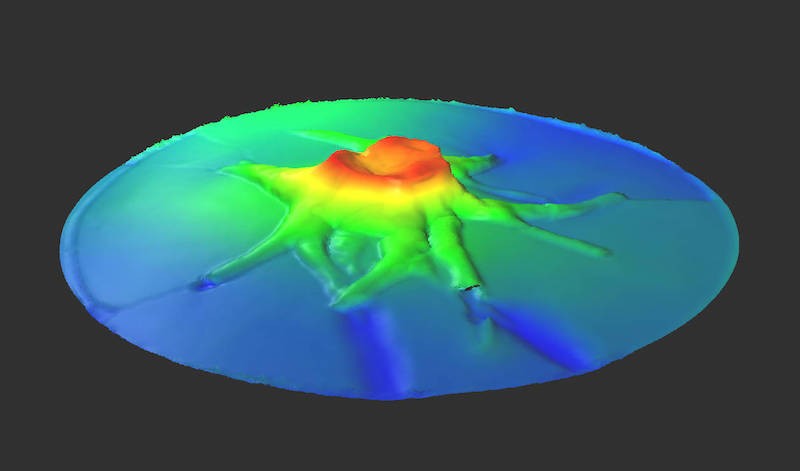
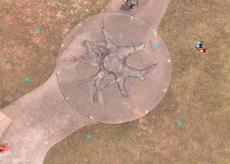
Elevation map of The Whitfield Stump.
