How TruePoint 3D Laser Scanning Benefits Engineers and General Contractors
Who is TruePoint 3D Laser Scanning?
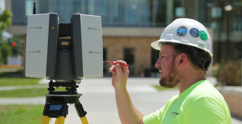
TruePoint conducts 3D laser scanning to provide a solution to outdated as-built drawings through the use of survey-grade laser scanners, delivering site data that is complete, clean and accurate. Since as-built drawings are often misdrawn, poorly kept, or even lost, site documentation has been perfected through TruePoint’s 3D laser scanning expertise. With the capacity to create a true digital twin, TruePoint provides accurate data fast and efficiently. Through deliverables such as 3D BIM models, 2D CAD drawings and point clouds, TruePoint informs project managers of existing conditions and accurate building information with 2-4 mm accuracy. This technology is invaluable to engineers and general contractors working on sites new and old.
Point Clouds & Models
TruePoint specializes in capturing above-ground 3D laser scan data and works to provide clients with intelligent deliverables that enhance the understanding of their site and informs decision-making at all levels.
These deliverables take on a variety of forms, but by far the most common is the initial form of data, the point cloud. By using state-of-the-art Leica laser scanners, TruePoint collects site data in individual points and creates a point cloud. TruePoint then takes these point clouds and produces custom deliverables for a project. Deliverables such as 3D BIM models, 2D CAD models and more are created of the site detailing structural, architectural and MEP features.
Using just the point cloud data, engineers and general contractors can easily view infrastructure, potential conflicts, and more. And a full 3D model provides even more benefits including the ability to do a virtual walk-through of the entire site.
TruePoint 3D Laser Scanning offers an opportunity for general contractors and engineers to rework outdated plans to negate the inherent risks, inferences and clashes before they happen. With TruePoint, these risks are mitigated, as we provide 2-4 mm accurate data and complete scans of entire sites. Using the deliverables mentioned above, TruePoint helps contractors take control of the project site by avoiding costly change orders and delays.
Why TruePoint?
Through the use of LiDAR (light detection and ranging), TruePoint Laser Scanning offers both an incredible and innovative service. By using Leica 3D laser scanners, we deliver data efficiently and with an accuracy of 2-4 mm. TruePoint has cataloged and recorded notable sites such as the Kennedy Space Center, NFL stadiums, LaGuardia Airport and so many more, that have each presented unique requirements or challenges. TruePoint uses this data to further develop our expertise in 3D scanning, helping clients plan for challenges before they arise.
We pledge to remain at the forefront of construction technology for our clients. Our powerful data collection methods provide a level of detail and accuracy that allows us to be the leading 3D laser scanning service provider to the architecture, engineering, and construction industries. Whether mapping historic buildings or providing new construction verification, TruePoint’s 3D laser scanning services offer a wide range of utility for many types of projects.
TruePoint’s experience in LiDAR 3D scanning, use of survey-grade lasers, and dedication to providing accurate data have made us the leading provider of 3D scanning for the architecture, engineering and construction industries. With a dedicated TruePoint team, quick and accurate scanning, and detailed deliverables, engineers and general contractors can rest assured, knowing their sites are properly documented and modeled.
To request a quote from TruePoint contact us here.