
Hotel Renovation Design Planning
Location: Dayton, Westlake, Strongsville and North Olmsted, Ohio
Task: TruePoint’s task was to 3D laser scan 4 existing hotels for renovation in the Dayton and Cleveland, Ohio area. The client needed as-built information of the common areas, guest rooms, meeting rooms and offices. They requested 2D floor plans of the architectural and structural elements of the hotel interior.
Challenge: Hotel management wanted data collected without disruption to guests or impact to occupancy. The client had a tight deadline; the design team needed data quickly to begin planning renovations, and they knew there was not an opportunity for site revisits for missed measurements.
Solution: To increase efficiency and minimize disturbance to the hotels, TruePoint used a hybrid scanning approach to capture the existing spatial layout for each hotel. The Leica RTC360 scanner was used to create control scans, which were then used to align the NavVis VLX mapping device’s scans. This saved both TruePoint and the client time and resources. In one day on site at each hotel, we were able to quickly capture more than 150,000 square feet of space, totaling over 600,000 square feet.
“Hotels have historically been difficult to scan because they are a pretty intensive small cut of spaces. Stationary scanners capture line of site and would have to be moved often to capture permanent records of the building. With the NavVis indoor mapping technology, we could move quickly through the building, capturing scans and 360 photos.” Michelle Collella, TruePoint Post Processing Technical Manager.
Deliverables: The client received point cloud data in Recap (.rcp file) and AutoCAD 2D design intent floor plans created from the point cloud data in DWG and PDF format for each floor of the hotel. The measurements and dimensions of the rooms within the hotel will be critical for their upcoming renovation project. They can also utilize the NavVis Indoor Viewer, a web-based application that transforms the data captured into immersive 3D buildings with a user-friendly interface. With a few clicks, scan data is quickly structured into a basic model of the building and can be displayed as realistic 360° walkthroughs, point clouds and customizable floorplans. Clients can move around scanned spaces as if they are on site and use the interactive functionality to add geo-tagged information and take accurate measurements.
Added Value: TruePoint understands the importance of operating within occupied environments. Our hybrid scanning approach captured a complete full interior layout of the hotels with incredible efficiency - minimizing time and disturbance and ensured the client would not need to perform site revisits for missed measurements had they used manual measurement methods.
For 3D laser scanning services in Ohio, contact:
- Cleveland | 216-470-7262 | cleveland@truepointscanning.com
- Cincinnati | 513-609-7244 | cincinnati@truepointscanning.com
- Columbus | 614-800-0378 | columbus@truepointscanning.com
- Toledo | 419-843-7226 | toledo@truepointscanning.com
TruePoint is a leading provider of 3D laser scanning services. Our team of engineers, architects and CAD technicians deliver the highest quality point cloud data, as built drawings and scan to BIM models, using state-of-the-art equipment, technology and processes. We use industry-leading survey-grade laser scanners to provide exact dimensions and measurements of large-scale projects such as buildings, sites, plants and facilities with an accuracy of 2-4mm.
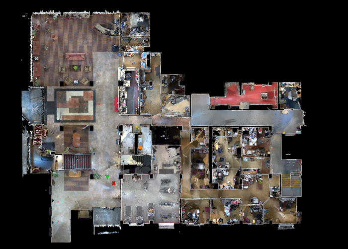
NavVis VLX screen capture of hotel lobby.
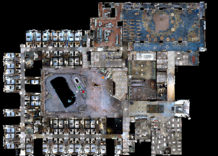
NavVis VLX hotel floor plan screen capture.
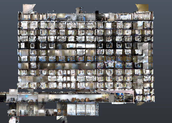
Elevation view of a slice of the hotel interior from the NavVis VLX laser scans.
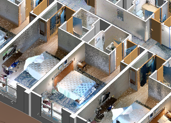
Image of Revit with the NavVis data overlaid in color.
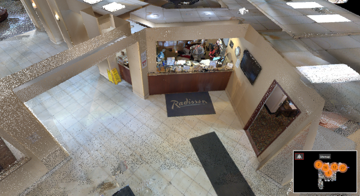
Hotel lobby with the NavVis VLX mobile mapping system.
This point cloud image was rendered in JetStream Viewer.
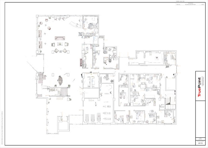
Hotel Lobby 2D Floor Plan
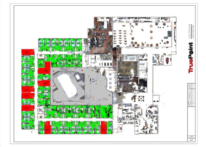
Hotel First Floor Plan
