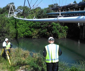
3D Laser Scan of Pipeline, Gary, IN. near Chicago Illinois
Case Study: 3D Laser Scanning of a Pipeline Located Over a River Using Non-Contact Measuring
Location: Gary, Indiana near Chicago, Illinois
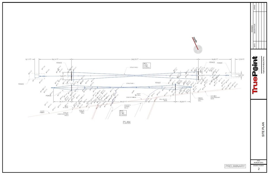
Task: To scan a pipeline spanning above a river, in order to capture the pipeline's dimensions and document and analyze its existing condition and support structure, including the extent of pipe sag.
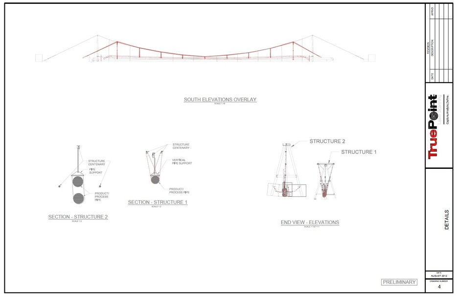
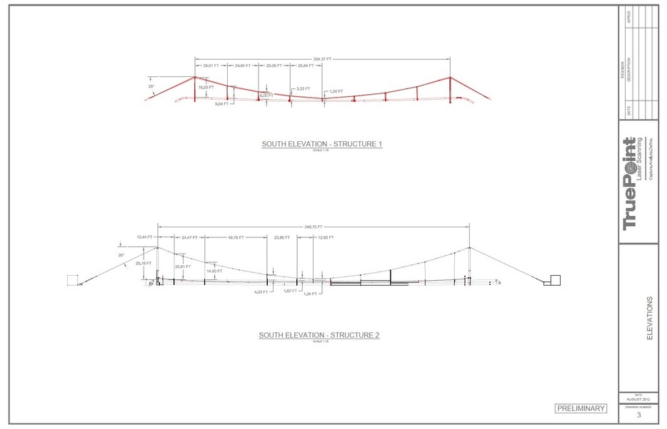
Challenge: The existing pipeline was showing signs of sag, evidence that the existing support structure which was carrying it across the river span could no longer adequately support the pipe. It was believed that the pipe itself did not need replacing, just its support system. Additionally, the engineering firm was interested in specific features, dimensions, and locations of the existing support brackets, pipe welds, and the sagging pipe itself. Traditional surveying methods, though, would have been both difficult and time-consuming, since the pipe's placement above the waterway made it not easily accessible.
Solutions: TruePoint Laser Scanning, LLC. used their 3D laser scanning technology as a non-contact measuring technique to safely, quickly, and accurately capture all of the key features of the pipe, right down to the exact measure of pipe sag. Additionally, the scanning technology was able to capture the features of the surrounding topography, information which will assist the engineering firm in replacing the support system and accessing it for repairs. Capturing certain key features, such as the support brackets, in a higher resolution allowed the engineering firm to get highly detailed information about the brackets while minimizing the amount of field time and data size.
Deliverable: For this project, the client was interested in a CAD model tied to state plane coordinates.
Added Value: TruePoint provided the client with 2D drawings such as a Plan View, Elevation and Section Detail of the pipe and of the pipeline's support structure and topography. Since the model was tied to state plane coordinates, the client also has an elevation for any point of interest throughout the model's scope.
If you have a project that requires a high level of detail that cannot be captured quickly, safely, or accurately using traditional methods, contact TruePoint today at 312-448-1509 or chicago@truepointscanning.com.