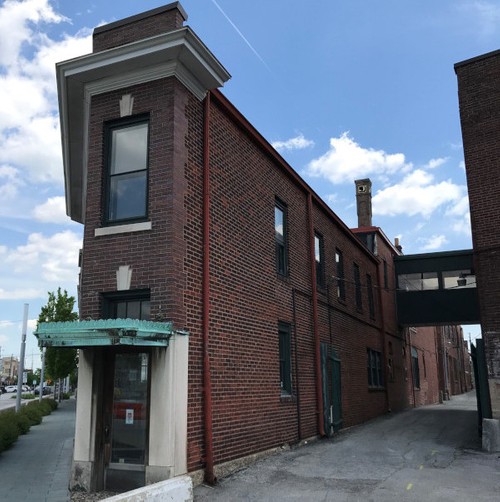
The façade of a corner building located on the company’s property.
Case Study: 3D Laser Scanning a General Contractor’s Headquarters
“Construction companies may not realize the value of a point cloud. Once imported into the software, the point cloud data can be parsed, manipulated, and modified to suit a client’s needs. It is the basis for management, analysis and advanced modeling.” -- Aaron Hunt, Lead Technical Manager
Location: Indianapolis, Indiana
Task: The headquarters of one of Indianapolis’s oldest and most established general contractors requested 3d laser scanning services. The client wanted to document the as-built conditions for historical documentation and renovation purposes. The 75,000 square foot site was made up of a number of different historic buildings, including offices, warehouses, wood shop and mill. TruePoint delivered fully registered intensity map point cloud files to the client.
Challenge: With the majority of the spaces within the facility being close to 100 years old or older, drawings of the spaces were outdated or non-existent. This client desired data to plan the renovation and repurposing of the unutilized space.
Solutions: TruePoint was able to capture the interior and exterior architectural features throughout the facility, which will be crucial in aiding with the future plans for the space. 200 scans were conducted with the Leica ScanStation P40 and RTC360 laser scanners.
Deliverable: Autodesk Recap point clouds in .RCS file format were delivered to the client. “Construction companies may not realize the value of a point cloud. Once imported into the software, the point cloud data can be parsed, manipulated, and modified to suit a client’s needs. It is the basis for management, analysis and advanced modeling,” according to Aaron Hunt, TruePoint’s Lead Technical Manager.
Added Value: The time it would have taken to manually measure and map out this project site would have been substantially greater than the time it took to laser scan it. The time saved and the guaranteed accuracy of the measurements are the benefits of the services we delivered to this client.
3D lidar scanning can be used for a variety of historical building engineering applications, from existing as-built drawings to plan for maintenance, to historical documentation of architecture and more. For 3d laser scanning service providers in Indianapolis, Indiana call 317-560-1565 or email indianapolis@truepointscanning.com.
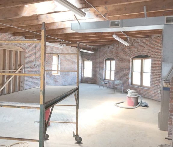
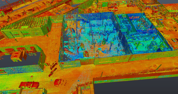
An image showing the existing, vacant, interior space on site.
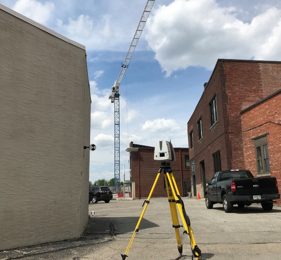
Leica P40 ScanStation capturing various building facades and a parking lot on site.
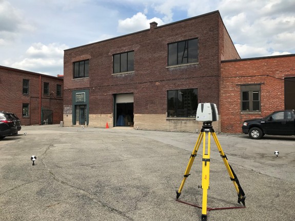
The Leica P40 scanner capturing another exterior building facade.
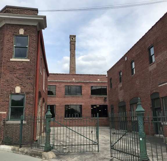
A view of some architectural elements on site, including a recently restored chimney.
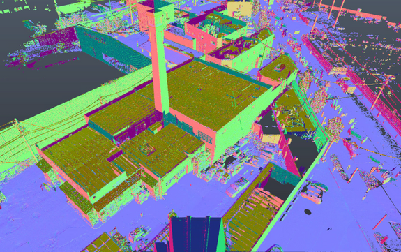
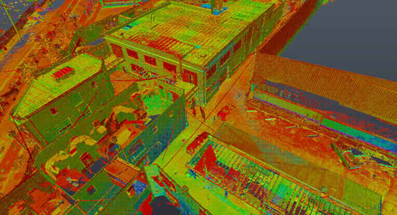
Intensity map point cloud screenshot of project site.
3d laser scanning aids renovations for this general contractor.
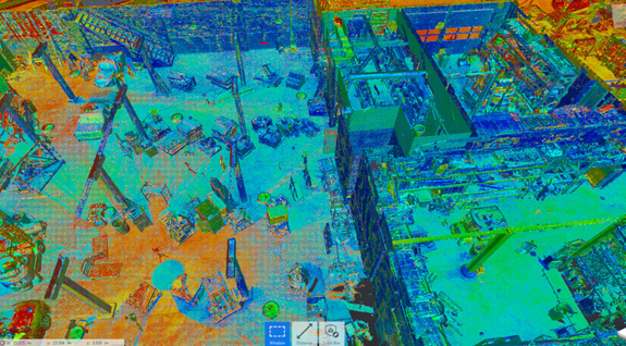
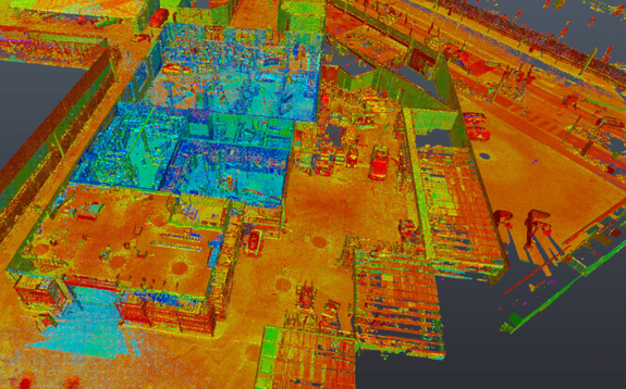
Image showing 3d building mapping and construction survey of project site.
Point cloud scanning of project site.
3d scanning for building survey produces intensity map point cloud of site.
