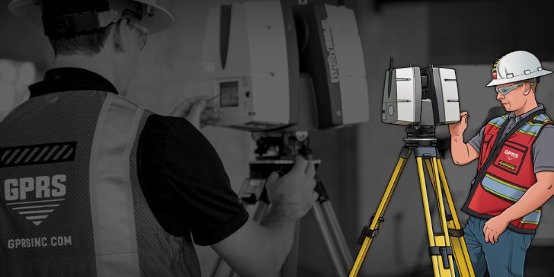
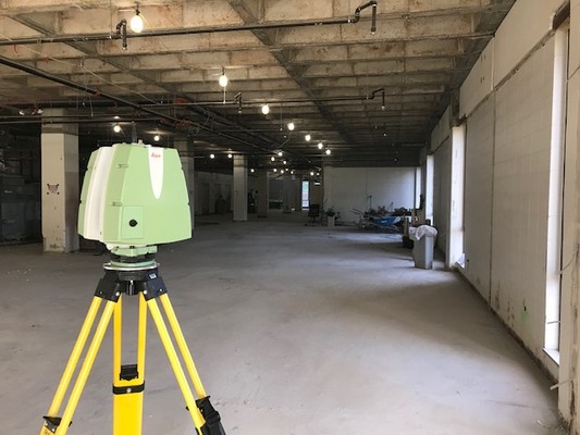
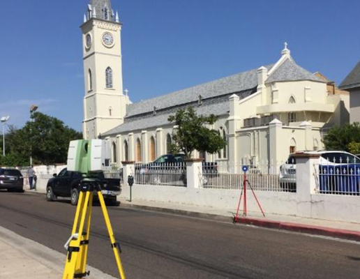
Resource Library
The mission of GPRS is to be a helpful resource to clients in need of 3D laser scanning or BIM modeling services. With that in mind, we have created a resource library to answer common questions. If you can't find what you need, please don't hesitate to call 419-843-7226 or email Laser@gprsinc.com.
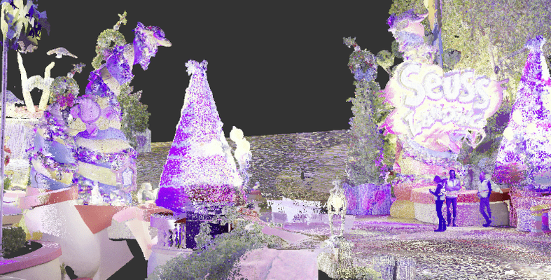
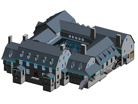
3D Mesh Model Helps Rebuild Famous Dr. Seuss Arch at Universal Studios Orlando
Precise as-built conditions were necessary to prefabricate new archway at the entrance of Seuss Landing at Universal Studios Orlando, Florida. GPRS was hired to 3D laser scan the entrance and develop a 3D mesh model for prefabrication. Concrete scanning was completed with ground penetrating radar (GPR) to make sure the rebar spacing could support the weight of the new prefabricated archway.
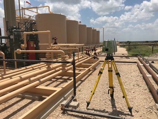
How As Builts and Utility Locating Aid Oil & Gas Companies
Access to accurate as built and utility infrastructure data is critical to the operations of Oil & Gas companies, as every aspect of facility management and project planning must be executed with precision.
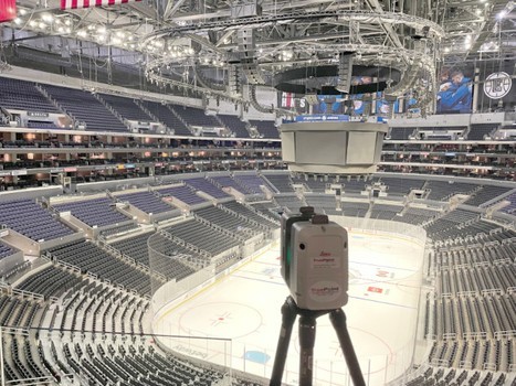
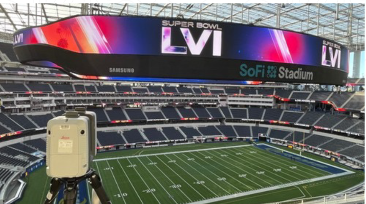
GPRS Laser Scans Stadiums and Arenas to Provide Precise Data for Signage and LED Video Display Installation
GPRS 3D laser scanning delivers accurate as built data for stadiums and arenas to install signage and LED video displays. Whether you are renovating aging stadiums or arenas or adding technological improvements, exact building dimensions and site information is critical to your decision making.
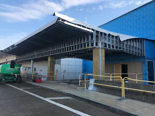
3D Laser Scanning and Utility Locating Accelerate Airport Renovations
Airports in the United States operate 24 hours a day, seven days a week, 365 days a year, resulting in non-stop wear and tear. They are aging fast; therefore, many airports are significantly investing in infrastructure development.
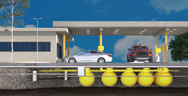
Gas Stations May Be Leaking Underground
Every gas station has the potential to leak and contaminate the surrounding community. Underground storage tanks and pipes can corrode, shift, or settle over time, causing tanks and pipes to crack, break, and leak. The result is disastrous, as petroleum can seep through the cracks and contaminate surrounding soil, ground water, surface water, or affect indoor air spaces.
What is Virtual Design and Construction?
Virtual design and construction is the process of using digital models of buildings and sites to collaborate on the design, process, schedule, and budget of a project before construction begins.

3D Laser Scanning Delivered Critical Dimensional Analysis for Wind Turbines
GPRS partnered with 2 renewable energy companies constructing an offshore wind farm to verify that the prefabricated components meet the design requirements. 3D laser scanning captured the exact dimensions of the components with 2-4 mm accuracy.

Laser Scanning Delivers As Built Data for the Installation of LED Video Displays
The Lloyd Noble Center, home to The University of Oklahoma men’s and women’s basketball teams, was adding a new LED video display over the top of the player’s entrance tunnel. The LED video display is one of a number of planned improvements to the aging Lloyd Noble Center.
How Much Can Be 3D Laser Scanned in a Day?
How much can be 3D laser scanned in a day? The amount of space that can be 3D laser scanned in a day can widely vary depending on the complexity of the environment being laser scanned, the 3D laser scanners used on site, the experience of the project manager, and the level of detail requirements.
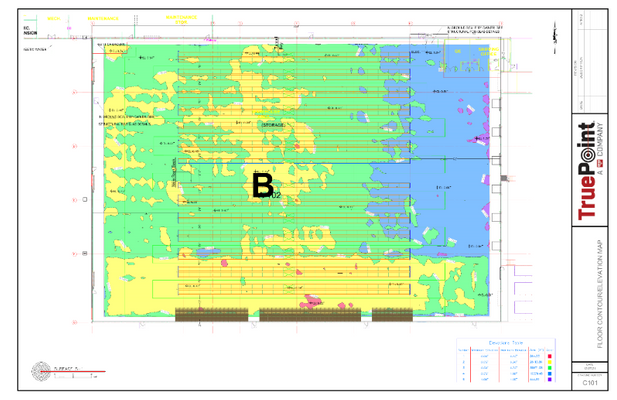
3D Laser Scanning Expedites BOMA Floor Measurement
BOMA has established standards for measuring and documenting the size and area of commercial buildings. 3D laser scanning is the most effective method to capture and accurately record a building's dimensions, geometry, and spatial layout.
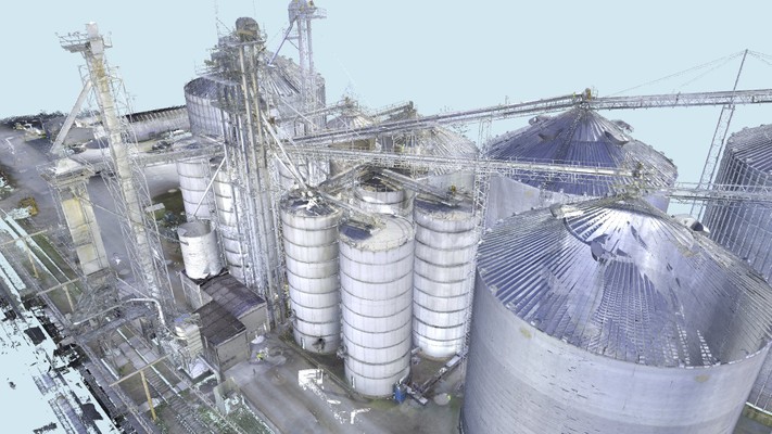
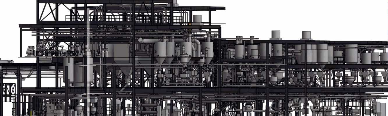
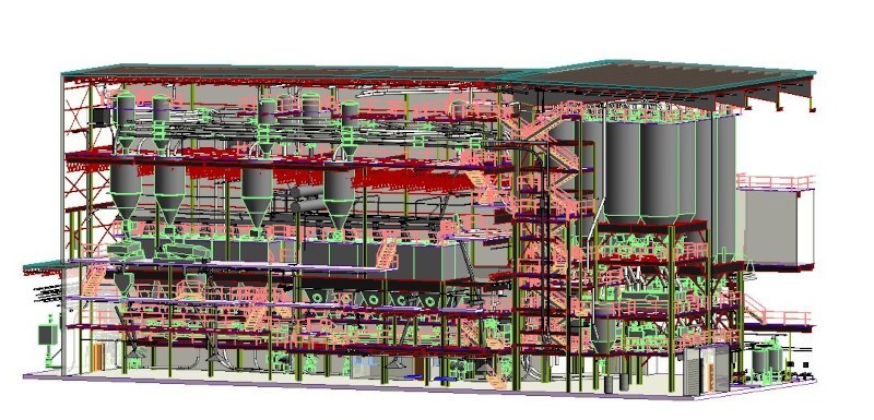
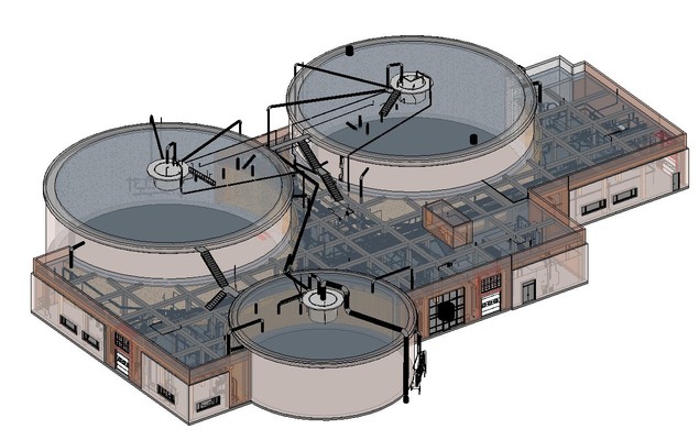
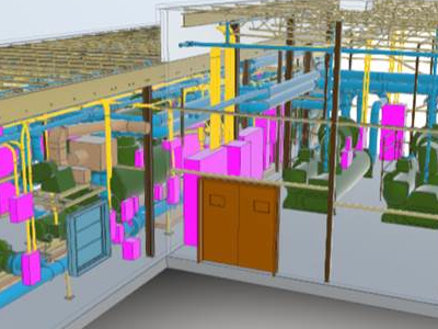
Technology Streamlines Grain and Feed Milling Facility Design, Maintenance
When it comes to the construction or modification of a grain processing or feed mill operation, technology is revolutionizing the way we engineer and plan these projects. Lisa Cleaver explains how 3D laser scanning digitally captures site information.

3D Laser Scanning Rent Vs Buy Vs Hire
There are three options to think through when considering 3D laser scanning for your project. Renting a LiDAR scanner for a short period of time, purchasing a LiDAR scanner, or hiring a professional 3D laser scanning company to perform the work for you.

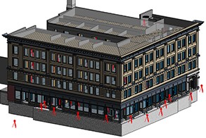
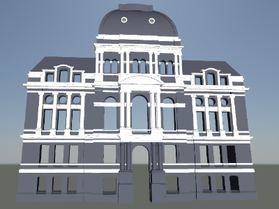
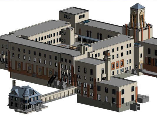
What is Revit Modeling?
Before Autodesk Revit, constructing a BIM model was difficult and time-consuming. Now the design process has become more straightforward and efficient. Revit is a powerful tool that has many benefits for architects, general contractors, sub-contractors, estimators, and fabricators.

SiteMap Infrastructure Asset Management Software

Construction Safety Week
Construction Safety Week is an annual event designed to raise the awareness of the industry's ongoing commitment to building a culture of safety through sharing best practices, tools and resources at job sites and offices across the U.S. When you hire GPRS to locate utilities or 3D laser scan, you are choosing to develop your project on a good foundation.

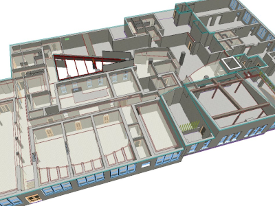
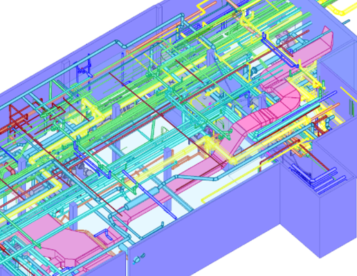
Everything You Need to Know About Scan to BIM
Scan to BIM is the process of capturing as-built details of an existing building or site with 3D laser scan technology and processing the data into a BIM model. Read more about as-built data capture, the creation of 3D BIM models, and the advantages of scan to BIM in this article.
3D Laser Scanning for All Phases of Construction
Laser scanning accurately captures, maps, and visualizes the 3D geometry of a building. Point cloud data is uploaded and processed into a file that can be loaded into modeling software. By implementing this into every phase of a construction project, architects, engineers, and contractors can increase accuracy and reduce risk.
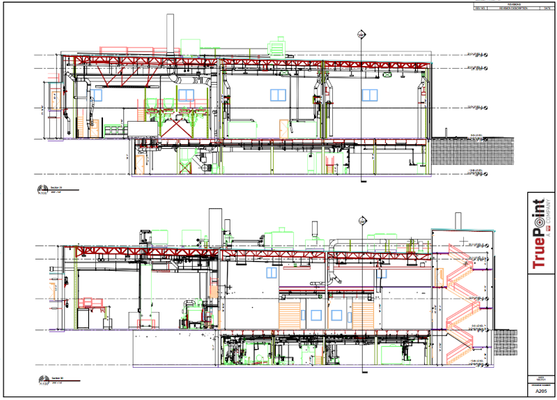
What Are As-Built Construction Drawings?
Construction drawings are an important tool for architects, engineers, and contractors, as they provide accurate and detailed technical information about a building or project site. Learn more about the common CAD drawings that can be created for your project.

3 Examples of 3D Laser Scan Technology Supporting the Entertainment Industry
3D laser scanning technology can be applied in exciting new ways. This is especially true within the entertainment industry. Here are a few examples of Mixed Reality (MR) fan experiences only made possible by our 3D laser scans, point clouds, 3D meshes, and BIM models.

7 Reasons to Use 3D Laser Scanning
3D laser scanning can provide many benefits for your project, including increased accuracy, time savings, reduced risk, improved communication, cost savings, high level of detail, and versatility. This article explains some of the main benefits of using this technology.
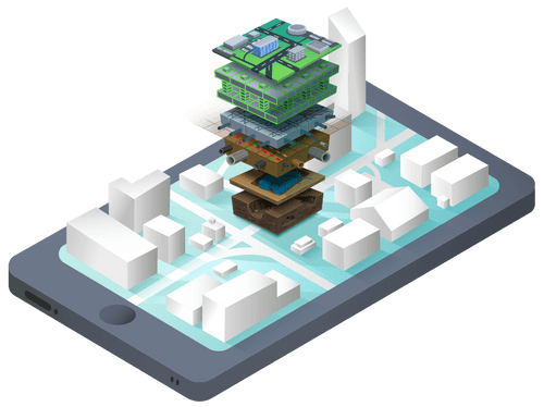
SiteMap: A Revolutionary Platform To View Facility Assets
SiteMap is a cloud-based digital platform that houses permanent records of site assets and infrastructure. It is designed to be an easy-to-use portal to store building and site documentation in one place, including subsurface utility maps, as-built drawings, 3D models, blueprints, maintenance records, permits, and more.

3 Ways General Contractors Reduce Costs With 3D Laser Scanning
Given their ability to improve quality and accuracy, provide immediate information, reduce manual labor, streamline coordination, and greatly cut costs, it’s no surprise that 3D laser scanning techniques have grown in popularity over the past few years.

Six 3D Laser Scanning Mapping and Modeling Deliverable Options
GPRS provides customizable 3D laser scanning deliverables for all your project’s needs, housed in SiteMap® a unique digital tool to help you collaborate better. No project is too big or complex. Whatever as-built project you need to visualize, we’re here to help provide you with the most accurate digital tools you need for success.

What is LOD? Level of Detail and Level of Development for BIM Models
There is often confusion between Level of Detail and Level of Development. While the terms are related, they have different meanings when it comes to 3D modeling. Level of detail is focused on the visual detail, while level of development is focused on the completeness and accuracy of the information included in the model.
How do you select the right 3D laser scanning company?
A savvy professional knows that not all service providers are alike. How do you evaluate 3D laser scanning service providers? What questions should you ask? What are the benefits to using a 3D laser scanning company?
Guide to 3D Laser Scanning for Concrete Construction
3D laser scanning is an innovative solution to assessing concrete. Contractors, inspectors, and designers can see issues and reduce errors with accurate data. Dimensional and tolerance assessments can be completed quickly to prevent costly project rework.

Mixed Reality Featured in College Football Playoff & National Championship
GPRS provided 3D data to make this mixed reality moment come to life. By 3D laser scanning the stadiums, the existing spatial layout was captured with great accuracy.
 to accurately pinpoint the location of each hazard and map it in detail, so there is never a question of where you can cut and where you can’t.")
GPR and 3D Laser Scanning Work Best Together
Ground Penetrating Radar (GPR) and 3D laser scanning work best as complements to one another to achieve the goal of keeping job sites safe and projects on time and budget.
A Complete Guide to the 3D Laser Scanning Process
Want to learn more about 3D laser scanning, the equipment used for data collection, and steps of the laser scanning process? 3D laser scanners are powerful instruments capable of mapping a space in exact 3D detail.
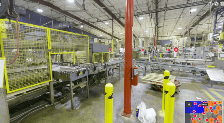
What is a TruView?
A TruView is a panoramic image of the point cloud as if you were standing at the position of laser scanner when it was capturing site data. Clients can easily pan, rotate and zoom the image, and have access to an intuitive set of mark up and measurement tools.
Building Renovations Surpass New Construction in 2022
For the first time in 20 years, renovations have overtaken new construction in architectural billings in the US. In 2005, renovations made up 34% of billings. In 2017, it was 44%. Bloomberg reports that renovations have surpassed 50% in 2022.
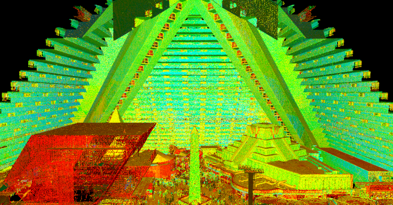
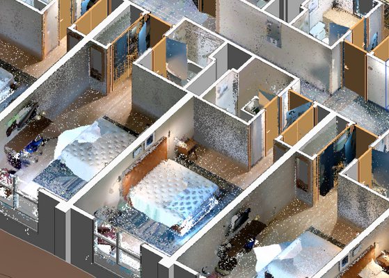
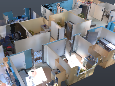
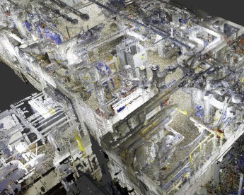
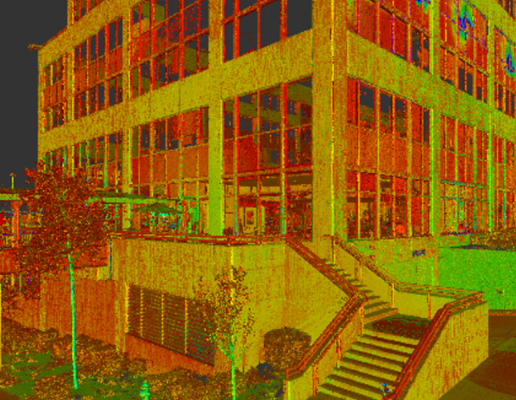
Point Clouds Explained
A point cloud is the set of 3D data points captured by a laser scanner. It contains the X, Y and Z coordinate of every visible detail of the project site. Point cloud data has become the new standard in design planning for the architecture, engineering and construction industry.
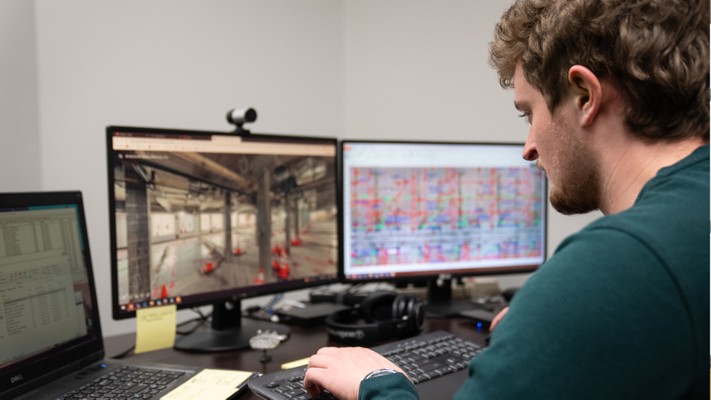
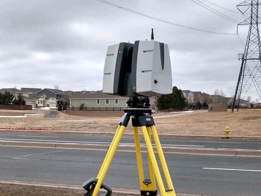
Laser Scanning Equipment and Data Platforms
GPRS offers a wide range of laser scanning, photogrammetry, and visualization services. We work closely with each client to define the project scope and use the right tools to achieve the accuracy and deliverables needed to successfully complete each project.
Advanced Analysis for Engineers
When you think about 3D laser scanning, you may think about documenting large-scale projects. But it can also be used to tackle technical engineering challenges. 3D laser scanning provides quantitative and definitive measurement data, removing human error from the collection process.

Mixed Reality at Gillette Stadium
GPRS 3D laser scanned Gillette Stadium to help The Famous Group create a ‘flying razor’ mixed reality experience. GPRS collected point cloud data of the stadium and delivered a 3D mesh model for The Famous Group to locate and place virtual objects in the correct camera space.
BIM Standards and Laser Scanning
The construction, engineering, and architecture industry has seen a recent update from The National Institute of Building Sciences regarding their ongoing initiative to create a nationwide standard for BIM models in design. September 2022 marks the third update to the proposed National BIM Standard.

What is Photogrammetry?
Photogrammetry reconstructs objects or environments through the use of photographs. Site photos are taken from the air or ground with a high-quality camera, capturing images from different locations and angles. The data captured provides enough spatial detail to allow for accurate calculations.
Assess Buildings After Natural Disaster
A rapid, detailed, and accurate infrastructure assessment is necessary after a natural disaster to capture a full and clear picture of the damage. GPRS can quickly collect data and assess your building or site with 3D laser scanning and BIM modeling services.
Glossary of 3D Laser Scanning Terms
This glossary of 3D laser scanning terms is available from GPRS Laser Scanning to provide general information about words and terms associated with 3D laser scanning. Learn more about colorized point cloud, colorized triangulated mesh, digital twin, terrestrial laser scanning, scan-to-BIM, and more.
What is LiDAR and How Does It Work?
LiDAR technology is deployed to collect highly accurate digital measurements used to create 3D models and 2D drawings of environments for construction and engineering projects. 3D scanners are the most accurate form of LiDAR. 3D scanners capture millions of three-dimensional data points, documenting the accurate existing conditions of a structure or site.

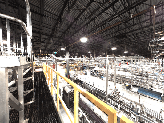
The Two Hidden Costs Of Not Measuring With 3D Laser Scanning
“Hazardous, tricky, and time-consuming,” is how CAD designer Kyle Artz describes trying to get accurate manual measurements of existing manufacturing facilities for as-built construction drawings. He recalled standing on a perilous catwalk, high above running machinery, stretching to try to measure parts of an active auto plant by hand.
Architectural Laser Scanning Minimizes Risks and Reduces Costs
Some architects consider the documentation of existing conditions to be an added expense. However, many have come to realize that accurate as-built documentation ultimately saves them time and money. Eliminating one change order related to unknown existing conditions can more than pay for the cost of the survey.
What is Scan to BIM?
Scan to BIM is the process of digitally capturing a site with a 3D laser scanner and using the data to create a BIM model. BIM can be thought of as a database of information ranging from project materials and cost – to the 3D model after construction – to operation of the facility. This information can be used to actively manage a project every step of the way.
What Are The Benefits To Laser Scanning In Color?
Some 3D laser scanners are equipped with digital cameras that capture high-quality color and texture information of a building or site. The scanner performs a second rotation after the initial scan is completed, takes hundreds of color pictures, stitches them together, and applies full color to a 3D point cloud.
GPRS Helps Pro Sports Leap Off The Screen
3D laser scan data is used to create mixed reality experiences for pro sports games. Since 2019, we’ve scanned football stadiums, basketball courts, baseball parks, golf courses, and ice rinks for the NFL, NHL, MLB, NBA, and the PGA to provide point clouds and models that are the framework for MR and AR experiences.
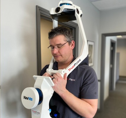
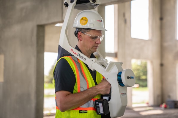
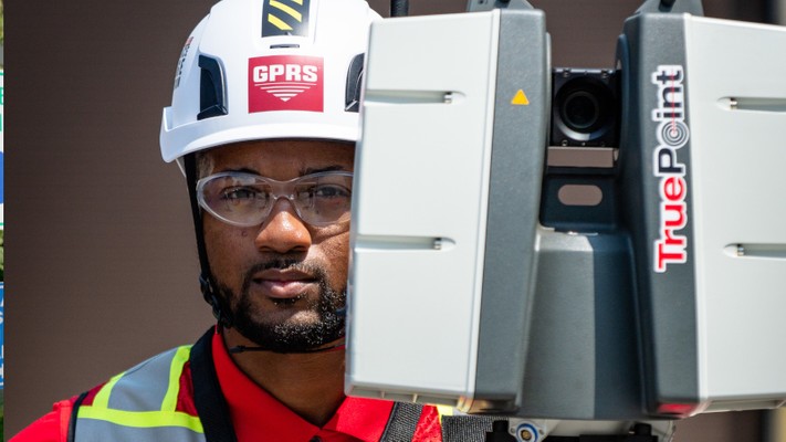
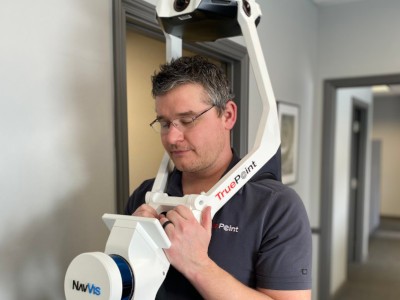
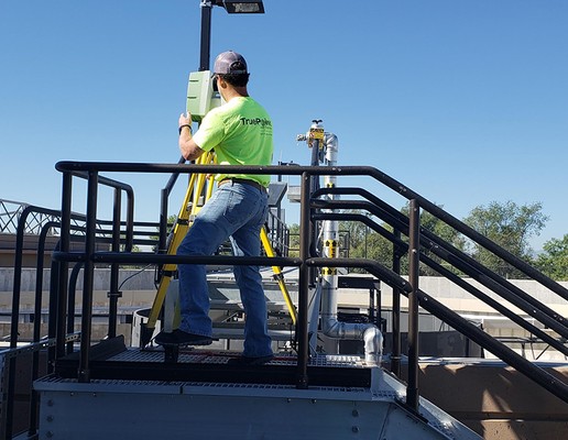
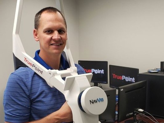
GPRS 3D Laser Scanning Can Map Above and Below
GPRS and TruePoint have combined services. With this new partnership, we can offer general contractors and engineers an above-ground and below-ground solution for scanning, mapping, and dataset storage.
How GPRS 3D Laser Scanning Benefits Engineers and General Contractors
GPRS specializes in capturing aboveground 3D laser scan data and works to provide clients with intelligent deliverables that enhance the understanding of their site and informs decision-making at all levels.
Top 3 Industries For 3D Laser Scanning Services
More and more industries are turning to 3D laser scanning to accurately collect as-built data from buildings, facilities and sites. Construction, engineering, and architecture are the top three industries that come to GPRS for 3D laser scanning services.
How To 3D Laser Scan a Building
To get precise measurements of a building, the best method is to 3D scan it. Laser scanning captures millions of measurements, documenting every detail into a digital map or point cloud. Read more about how to 3D laser scan a building.
5 Types of Drawings Used In Building Construction
Construction drawings serve an important purpose in building construction. 2D drawings are used to document existing conditions, propose modifications, quantify materials, and assess compliance with local building codes.
How Much Does Laser Scanning Cost?
Ultimately, the cost of 3D laser scanning a building depends on the size complexity of what is being scanned. Read more about the information needed to price a 3D laser scanning project and how the lowest priced bids could be taking a shortcut on quality.
What is a Digital Twin?
A digital twin is a virtual model that accurately represents an existing physical space. It digitally represents a building’s architecture, structure and systems. The most useful purpose of a digital twin is for construction design planning.
7 Tips Before 3D Laser Scanning
Preparing project information before laser scanning can bring huge benefits. At GPRS, we have turned our experience into advice to make your project successful. Here are 7 tips to read before you begin laser scanning.
All You Need to Know About Point Clouds
A point cloud is the step before an accurate 3D model of a site is created. It’s the starting point for digital reality, a map of points in space, which are processed to become 3D models of buildings, plants, civil infrastructure, historical sites & much more.
Everything You Need to Know About Construction Laser Scanning
Are you using 3D laser scanning on your construction projects? Every construction professional would benefit from learning the advantages of 3D scanning buildings or construction sites. Many construction projects lack current as built drawings.
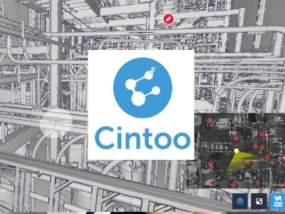
Cintoo Cloud Platform Expedites Data Delivery
Cintoo Cloud is a platform that expedites the delivery of data to clients, allowing them to view laser scan data and models from their web browser. Cintoo Cloud eliminates the need to upload projects to file sharing services or copy to hard drives.
The Benefits Of Hybrid Laser Scanning Workflows
A hybrid workflow is using both terrestrial laser scanners and mobile mapping devices on a project site. We believe this is the next-generation of technology for the AEC community to create digital twin solutions.
3D Laser Scanning Poised to Electrify Construction Industry
The construction industry has been experiencing a digital transformation for a while now. This transformation has been greatly accelerated by contractors’ need to adopt high-tech tools in a remote environment to keep projects moving.
Can You Convert a Point Cloud to a Mesh?
GPRS can create a 3D mesh in .fbx, .stl, .obj, and .ply file formats from a LiDAR point cloud. Meshes can be used for repairing or restoring scanned elements with fine, organic details that are otherwise difficult to reproduce in CAD.
9 Scan-to-BIM Terms You Need to Know
A mini glossary of basic scan-to-BIM terms, and the difference between BIM and other concepts like VDC and digital twins. You may be researching scan-to-BIM workflows and getting a little mixed up with all the three-letter acronyms and specialized terminology.
Why Should You Incorporate Reality Capture Into Your Construction Project?
Reality capture captures incredible site detail. Each point is captured and mapped onto an XYZ coordinate system for an intelligent survey output to remove any guesswork from decision making.
What Are The Benefits of 3D Laser Scanning?
3D scanning is the most effective solution for documenting the existing conditions of any environment. Highly accurate as built data is quickly captured for use in construction and engineering projects.
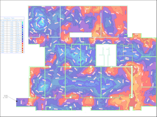
A Complete Guide To Evaluating Mobile Point Cloud Quality
In this blog, we’ll explain the metrics that laser-scanning experts use to determine the quality of a mobile point cloud, and then show you the simple process that they use to audit a data set – all without the need for complex analysis tools.
How To Get The Highest Quality 3D Visuals For Accident Sites
In this post, we answer your questions about 3D laser scanning and show how this technology supports our clients in designing state-of-the-art visual solutions that help them settle their accident sites and incident scene cases faster.
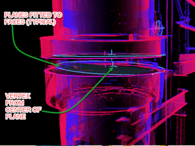
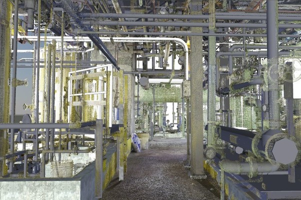
3D Laser Scanning Complex Engineering Projects
When you think about 3D laser scanning, you may think of documenting large-scale buildings, plants or facilities. But it can also be used to tackle extremely technical engineering challenges.
5 Unique Benefits Of BIM
Building Information Modeling (BIM) is an intelligent 3D model that gives architecture, engineering and construction (AEC) professionals the insight and tools to more efficiently plan, design, construct and manage buildings and infrastructure.
3 Ways Laser Scanning Is Used In Construction
Laser scanning is one of the most innovative additions to construction, and it has changed the way that buildings are captured, designed, and managed. Read the ways laser scanning improves project coordination and collaboration.
The 5 Most Asked Questions on 3D Laser Scanning
3D laser scan technology has made rapid advancements in the construction and engineering industry for more than 20 years. Below is a list of common questions we at GPRS 3D Laser Scanning have been asked over the years.
3D Laser Scanning Process
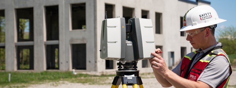
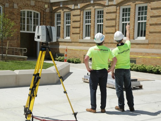
GPRS is a leading provider of 3D laser scanning services, helping clients to successfully complete their most complex projects with accurate as-built documentation and custom deliverables. The 3D laser scanning process at GPRS involves the following steps:
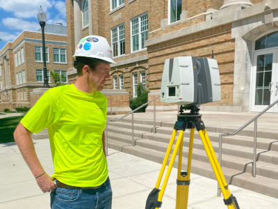
Why Do We Use Leica Laser Scanners?
As the popularity of 3D laser scan technology has accelerated, so has the expansion of scanner types and brands. We believe Leica has the best 3D laser scanners on the market, delivering outstanding range, speed and the highest quality 3D data. Read more on why we use Leica laser scanners.
When Should I Use Laser Scanning?
This guide for general contractors tells when to use laser scanning in building construction. This article details many areas such as determining your data needs, workflows, software and hardware to provide the best solution for your project.
What is a Point Cloud?
If you're taking a laser scan of your site’s as-is conditions and plan to use that information to model, estimate, detail, or make renovations to a project, you might want to understand what a point cloud is.
Top 10 Reasons to Hire an Experienced Laser Scanning Company
Laser scanning looks easy… you just push a button, right? Well, let me tell you that not all 3D laser scanning companies are created equal. Here are the top 10 reasons to hire an EXPERIENCED laser scanning company:
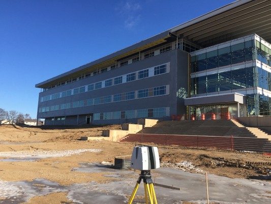
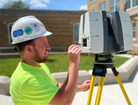
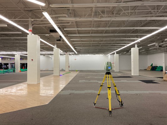
What is 3D Laser Scanning?
3D laser scanning is the most effective solution for measuring and documenting the existing conditions of any environment. Read about the process, uses and benefits of laser scanning.
Justifying the Cost of Laser Scanning
Why should I invest in 3D laser scanning? This article tells why laser scanning provides immeasurable value to your project. It touches on determining the correct project scope and deliverables.
Top 6 Misconceptions About Laser Scanning
Proactive laser scanning can reduce site visits and loss of production due to being in the field instead of working on design or other aspects of the project. This article speaks to common cost, point cloud and modeling misconceptions.
What is the Difference Between a Design Intent and As-Built Model?
One of the first questions we ask clients is “Do you want create the perfect model reflecting the original design intent or a model to reflect the as-built field conditions?” When this question is understood and answered, GPRS’s team of in-house engineers can create the best model for your project.
What is the Importance of Registration?
Registration is an important process in identifying and removing noise to provide the most accurate point cloud data set. Read what sets GPRS apart in post-processing registration.
5 Reasons Why It’s Time to Invest in Mobile Mapping
Mobile mapping systems improve your scanning efficiency so you can finish big projects faster, and take on more projects, with your existing workforce. Learn how mobile mapping can transform your business.